
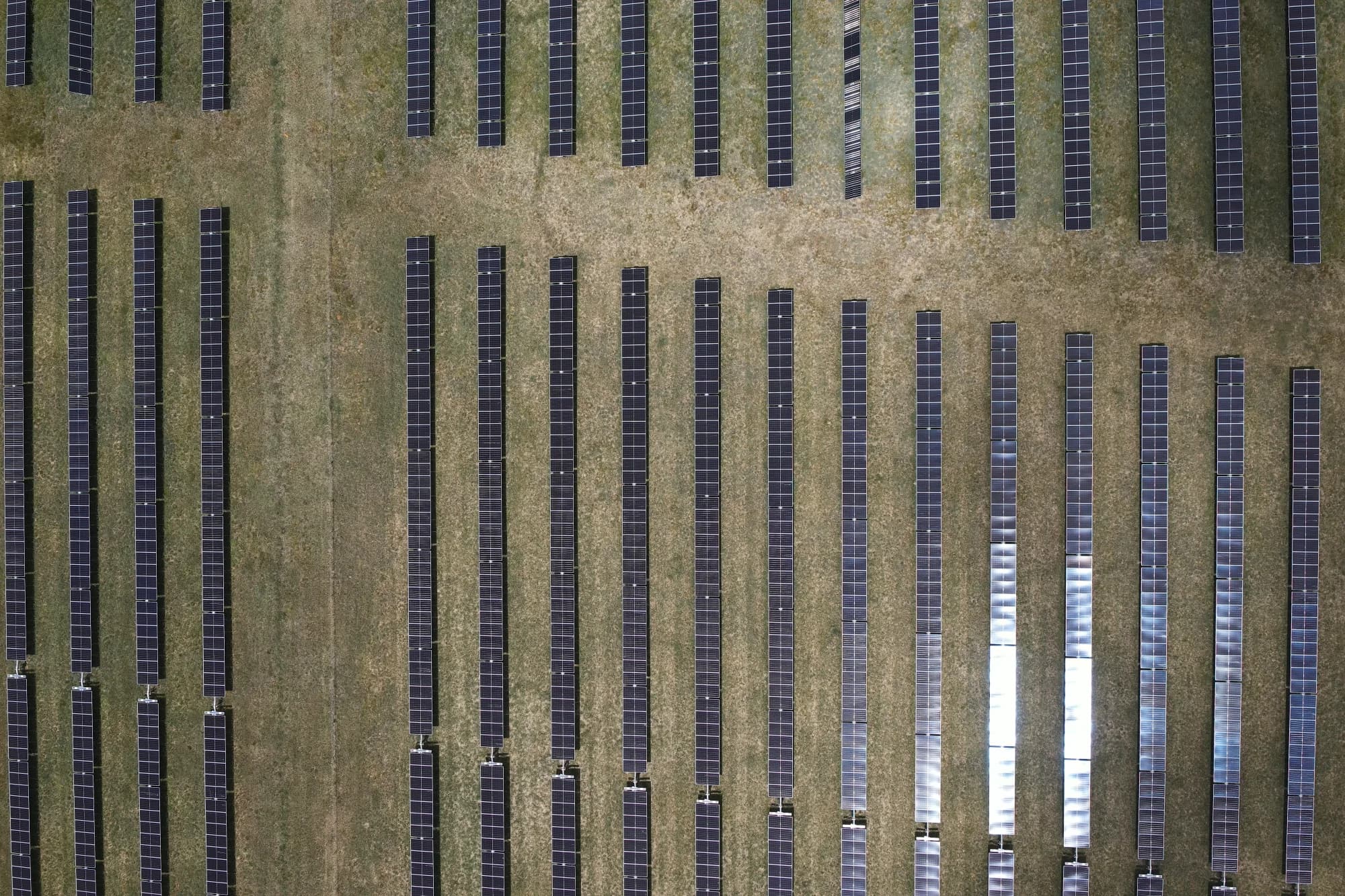
New England Solar Farm Drone Thermal Inspection
Overview
New England Solar Farm is a large renewable energy asset in northern New South Wales. The inspection scope covered approximately 520 MW of solar generation infrastructure and required a capture method that could operate consistently across a very large site.
National Drones developed a solar farm drone inspection program using thermal imaging, RGB aerial photography and orthomosaic mapping. The objective was to create structured, reviewable evidence without relying on slow, module-by-module ground capture.
The Challenge
Utility-scale solar inspection is a data and logistics problem as much as it is a flight task. The team needed to coordinate aircraft, cameras, pilots, weather windows and thousands of images while maintaining consistent coverage across the asset.
Thermal survey quality also depends on stable operating conditions. Irradiance must be high enough to make temperature differences visible, while cloud, wind and reflected heat can reduce confidence in the imagery. Flight settings, overlap and ground sampling distance must remain controlled from one capture block to the next.
A Specification-Controlled Capture Program
The project planning records reference the principles of IEC TS 62446-3:2017 for outdoor infrared thermography of photovoltaic systems. The planned capture targets included:
- Radiometric thermal imagery for module and string-level review
- High-resolution RGB imagery at approximately 3 centimetres per pixel
- A minimum irradiance threshold of 600 W/m² during thermal capture
- Planned use of multiple aircraft and camera systems to cover the site efficiently
- Defined flight blocks and naming conventions for traceable data handling
- RGB orthomosaic capture to provide site-wide visual context
These targets gave each flight team a common operating method for capture across the large inspection area. The available records do not establish independent acceptance against every proposed target.
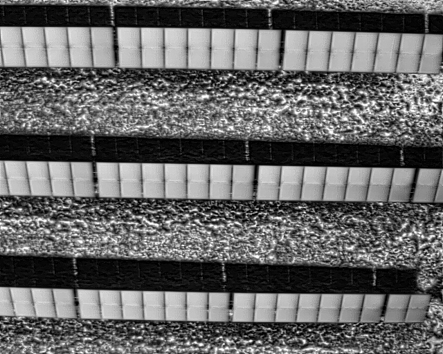
Radiometric thermal frame from the New England Solar Farm capture program. The image shows thermal contrast across the array; it is not presented as a confirmed defect finding.
Thermal and RGB Orthomosaic Coverage
The project imagery includes thermal and RGB orthomosaic map views. These views combine many source images into broader site records that show complete panel rows, access routes and the displayed capture footprint.
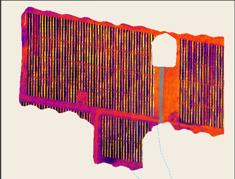
Thermal orthomosaic map view from the New England Solar Farm project. The false-colour display shows thermal contrast across the mapped area. The pale canvas, cyan dashed overlay and dark border are part of the source software export; they are not defect classifications.
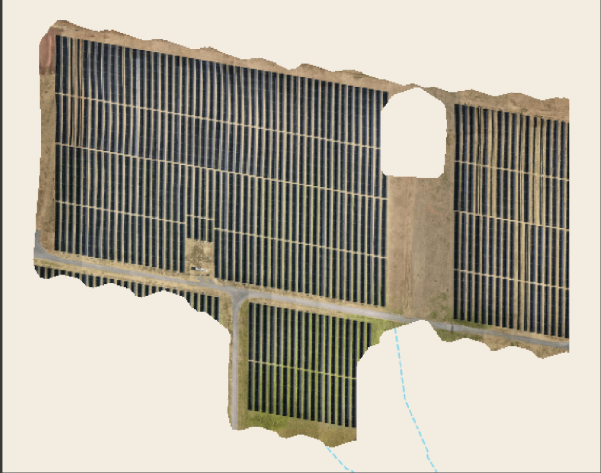
RGB orthomosaic map view from the New England Solar Farm project. It provides visual context for the solar-array layout and access routes. The pale canvas and cyan dashed overlay are part of the source software export.
Managing More Than One Terabyte of Aerial Data
The project repository contains more than one terabyte of New England Solar Farm capture data. It includes the main survey dataset, dedicated orthomosaic flights and follow-up capture organised by flight and site zone.
That structure is important. A solar inspection only creates value when imagery can be traced back to the correct flight area, reviewed efficiently and connected to a maintenance workflow. Clear data organisation also makes it easier to compare future inspections against the same asset baseline.
The Result
The available project repository records a high-volume, multi-stage aerial capture program across a utility-scale solar asset. The resulting data library contains:
- Broad site coverage: aerial capture across a 520 MW inspection scope
- Detailed visual evidence: RGB imagery suitable for orthomosaic mapping and asset context
- Thermal inspection data: radiometric imagery for identifying areas that need further review
- Traceable delivery: data organised by flight, zone and capture campaign
- A repeatable baseline: a structured record that can support future condition comparisons
This project shows how disciplined flight planning and data management make thermal drone inspection practical at utility scale. Learn more about National Drones' thermal drone inspection services.
For a repeat inspection program on another major solar asset, see the Bungala 1 and 2 solar farm case study.
Need Consistent Solar Farm Inspection Data?
National Drones plans and delivers thermal, RGB and mapping programs for renewable energy assets across Australia. Talk to our team about a utility-scale drone inspection.