3D Modelling
Create a 360-degree vision of your project. Visualise your assets from every angle with photorealistic, GPS-accurate 3D models.
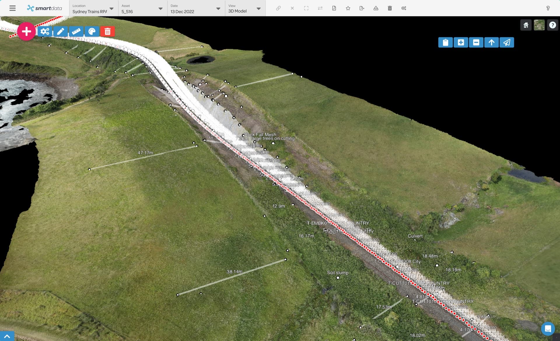
Visualise Your Project from Every Angle
National Drones leverages SmartData to construct three-dimensional models by processing hundreds of high-resolution images. Each point in the resulting model contains GPS coordinates, enabling accurate digital representations of physical assets with support for KMZ and SHP file integration.
What You Can Do
The 3D Modelling platform provides a comprehensive toolkit for digital asset management.
Key Features
From digital twins to volumetric analysis, explore the full power of 3D modelling.
Digital Twin Creation
Our high-resolution imagery allows the creation of interactive, photorealistic 3D models accessible from a standard web browser. Each point contains GPS coordinates for accurate digital representations.
Change Analysis
Compare multiple datasets side-by-side through the platform's web interface to track asset conditions across different time periods and identify deterioration early.
Asset Condition Monitoring
Take a snapshot of an asset's condition at a set point in time to keep an accurate digital record. Monitor changes over scheduled intervals to support predictive maintenance.
Multi-Format Visualisation
View 3D meshes, point clouds, and CAD models simultaneously on one platform. Supports KMZ and SHP file integration for comprehensive spatial analysis.
Quarry & Mine Management
Monitor inventory, construction projects, and stockpile measurements with regular flyovers. Calculate volumes and track extraction progress with precision.
Cloud-Based Documentation
Transform 2D PDF drawings into cloud-based, shareable 3D models with embedded data. Enable team collaboration and stakeholder access from anywhere.
Want to See SmartData in Action?
Open the public viewer sandbox or book a walkthrough of SmartData 3D workflows.
Ready to See What Drones Can Do?
Tell us about your project and we'll send you a tailored proposal — most quotes are turned around within 24 hours.