2D Mapping
High-resolution land mapping technology with orthomosaic imagery and terrain data at less than 3cm per pixel.
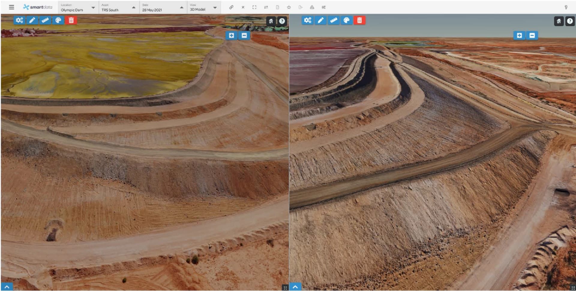
A Complete Overview with Identifiable Detail
The SmartData platform displays orthomosaic imagery and terrain data via an interactive viewer. With resolution down to less than 3cm per pixel, you can annotate, measure, and mark areas before sharing through a web-based interface for seamless project integration.
Key Capabilities
From vast area visualisation to safety-focused roof mapping, our 2D Mapping software delivers actionable insights.
View and Explore Vast Areas
Deliver high-quality imagery covering hundreds of square kilometres. The interactive 2D Viewer enables review and annotation without ground exploration or manned aircraft, offering superior resolution compared to satellite imagery at lower costs.
Track Your Changing Landscape
Enable real-time monitoring of geological and topographical changes. BVLOS-certified pilots can access otherwise inaccessible terrain and unstable grounds to capture up-to-date data.
Reduce the Risk of Working at Heights
Create complete roof maps in high resolution, eliminating traditional risks from elevated work platforms or climbing. Particularly valuable for older or structurally compromised buildings.
Improved Vegetation Management
LiDAR-equipped drones assess power transmission line sag and vegetation proximity, reducing outages and improving asset management efficiency in power networks.
Who It's For
2D Mapping is used across industries where accurate, up-to-date spatial data is critical.
Mining & Resources
Monitor stockpiles, terrain changes, and site progress.
Energy & Utilities
Assess transmission lines, vegetation clearance, and substations.
Agriculture
Track crop health, irrigation, and land use over time.
Construction
Measure earthworks, monitor progress, and plan site logistics.
Want to See SmartData in Action?
Open the public mapping sandbox or book a walkthrough for your own project data.
Ready to See What Drones Can Do?
Tell us about your project and we'll send you a tailored proposal — most quotes are turned around within 24 hours.