RBAK - Basic Aviation Knowledge
Height, Altitude, Elevation and Aviation Units
Separate height, altitude and elevation, then apply the units remote pilots meet in aviation weather, charts and operations.
Lesson record
- Status
- Current source aligned
- Reviewed
- 2026-05-18
- Source pages
- RePL Study Guide pp. 29-35; Part 101 MOS C10 p. 92.
- Reviewer
- National Drones publication review
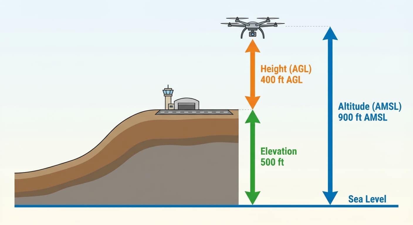
The datum changes the meaning
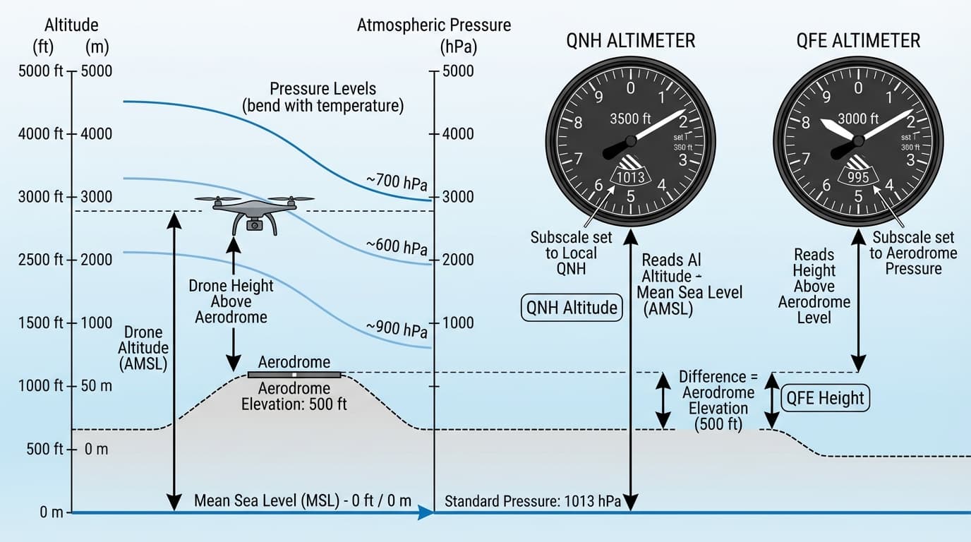
Height is vertical distance above a specified datum, usually the ground directly below the aircraft. Altitude is measured above mean sea level. Elevation is the height of a fixed point, such as an aerodrome or hill, above mean sea level.
A drone display often shows height relative to the launch point. A crewed aircraft altimeter normally references mean sea level when set to QNH. That difference can create a dangerous misunderstanding near aerodromes or terrain.
Think in both AGL and AMSL
If a drone is 400 ft above a site that is 1500 ft AMSL, the aircraft is about 1900 ft AMSL. A crewed aircraft reporting 2000 ft near the same site may be much closer than a new remote pilot expects.
The remote pilot should know the elevation of the operating site and understand whether the aircraft display is showing relative height, terrain-following height or another estimate.
Use the right unit for the context
Australian aviation commonly uses nautical miles for navigation distance, feet for altitude and elevation, knots for wind and aircraft speed, metres or kilometres for visibility, Celsius for temperature, hectopascals for pressure and kilograms for weight.
RPA manuals may also use metres per second, kilometres per hour, pounds or Fahrenheit. Conversions are not academic; they are part of checking limits before flight.
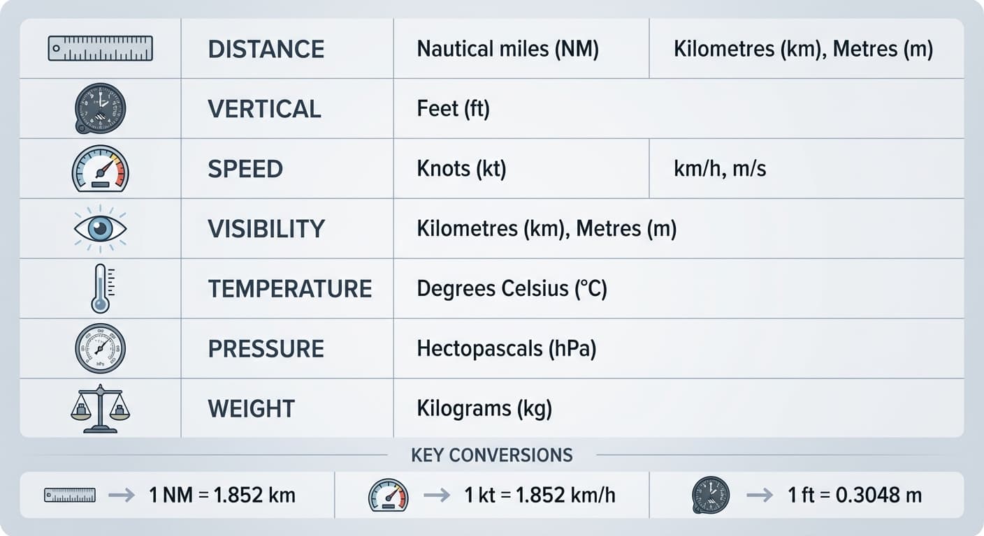
- 1 nautical mile is 1.852 km.
- 1 knot is 1 nautical mile per hour.
- Kilograms to pounds is approximately kg x 2.2.
- Standard sea level pressure is 1013.2 hPa.
Practice Questions
A drone is 400 ft above a launch site with an elevation of 1500 ft AMSL. What is its approximate altitude AMSL?
- 400 ft
- 1100 ft
- 1500 ft
- 1900 ft
Answer: 1900 ft
Add the drone height above ground to the site elevation: 1500 ft + 400 ft = 1900 ft AMSL.
Next step after study
Complete your Remote Pilot Licence training
The free study guide is a strong theory foundation. To actually be issued with a RePL, students still complete approved training, practical flying and assessment with a certified provider.