RBAK - Basic Aviation Knowledge
Map Position, Latitude/Longitude and Runway Orientation
Use latitude, longitude, true and magnetic direction, runway numbers and clock-code references to describe where an RPA operation is happening.
Lesson record
- Status
- Current source aligned
- Reviewed
- 2026-05-18
- Source pages
- RePL Study Guide pp. 11-29; Part 101 MOS C10 pp. 92-95.
- Reviewer
- National Drones publication review
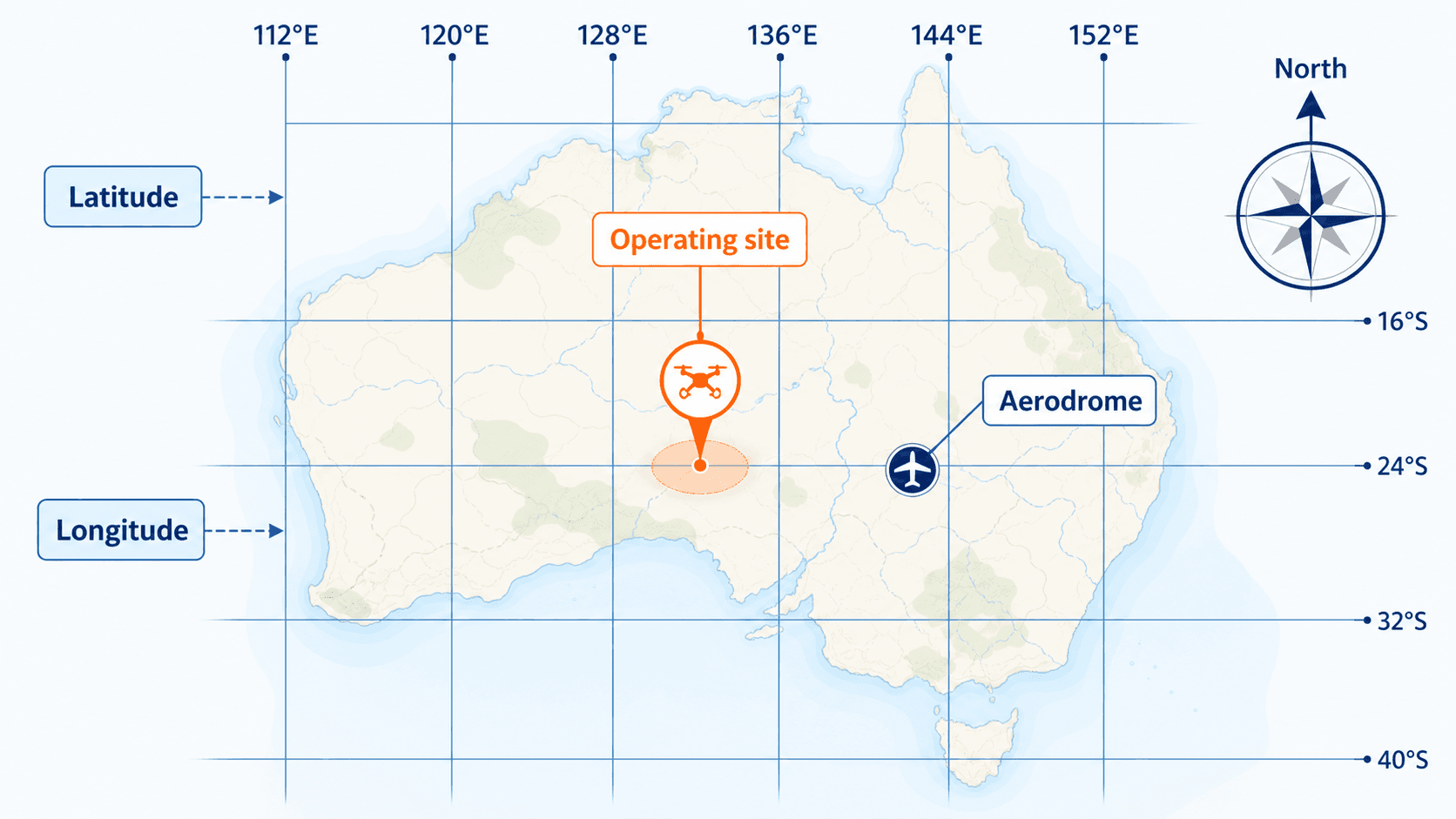
Image provenance: Generated with the built-in GPT image tool on 2026-05-18 from a National Drones educational prompt; fictional map for visual learning; no operational approval is implied by the image.
A map turns the flight into a position problem
Before a remote pilot thinks about altitude, airspace or weather, they need to know exactly where the operation is. Aviation charts, approved apps and operator procedures all start with a position: the operating area, nearby aerodromes, controlled airspace, restricted areas, terrain and emergency landing options.
Latitude and longitude give that position a common language. They let a pilot, observer, chief remote pilot, air traffic service or emergency service talk about the same place without relying on local descriptions such as beside the shed or near the creek.
- Use coordinates to define the operating site and nearby hazards.
- Use current chart and app data to check what surrounds the site.
- Keep screenshots or records only where your operator procedures require them.
Latitude and longitude are the grid
Latitude lines run east-west across the chart, but they measure how far north or south a position is from the equator. In Australia, latitude is normally written south, such as 27°S.
Longitude lines run north-south across the chart, but they measure how far east or west a position is from the Greenwich meridian. In Australia, longitude is normally written east, such as 153°E.
The simple check is this: latitude tells you north/south position; longitude tells you east/west position. Do not swap them when copying coordinates into an app, flight plan or job note.
- Latitude first, longitude second is the normal aviation and mapping convention.
- South and east matter. A missing S or E can put a coordinate in the wrong hemisphere.
- Decimal degrees and degrees/minutes/seconds are different formats; convert carefully.
True north and magnetic north are not the same thing
True north points to the geographic North Pole. Magnetic north points toward the earth's magnetic field, and the angle between true north and magnetic north is called variation.
Charts and aviation procedures may use true or magnetic direction depending on the context. A runway number is based on magnetic direction. Some planning tools and maps may display true direction unless configured otherwise.
For RePL study, the important habit is not memorising a local variation. It is checking what reference the source is using, applying the conversion correctly and recording the direction in the same reference system as the procedure or chart.

Runway numbers are direction clues
Runway numbers are shorthand for magnetic direction rounded to the nearest 10 degrees. A runway marked 04 is aligned roughly 040° magnetic. The opposite end is about 180° different, so it is marked 22.
Remote pilots are not using runway numbers to land an RPA unless authorised and trained for the operation. The value here is orientation. If a nearby aerodrome has runway 04/22, you can quickly picture likely approach and departure directions and brief observers more clearly.
That does not replace an airspace or aerodrome check. It simply gives the pilot another visual anchor when interpreting charts, NOTAMs, ERSA information or aerodrome procedures.

Clock code is relative, not geographic
Clock-code direction is useful when a pilot or observer needs to point out traffic quickly. It does not describe north, south, east or west. It describes where something sits relative to the aircraft nose or another briefed reference.
If an observer says traffic is at 2 o'clock, the pilot should understand it as ahead and to the right of the reference direction. For RPA work, agree the reference before the flight because the pilot, observer, controller screen and aircraft nose may not all face the same way.
Good crews avoid clever wording. If clock code could be ambiguous, add plain language: helicopter at 2 o'clock, high, moving left to right, north of the site.
- Use compass direction for fixed locations.
- Use clock code for quick relative traffic calls.
- Add altitude, movement and threat level when it helps the pilot decide.
Practice Questions
A coordinate is written as 27°S 153°E. Which part is latitude?
- 27°S, because latitude measures north or south of the equator.
- 153°E, because latitude measures east or west of Greenwich.
- Both parts are latitude.
- Neither part is latitude unless written in decimal degrees.
Answer: 27°S, because latitude measures north or south of the equator.
Latitude is north/south position. Longitude is east/west position.
A runway marked 04 is approximately aligned with which magnetic direction?
- 040°
- 004°
- 140°
- 400°
Answer: 040°
Runway numbers are rounded magnetic directions with the final zero removed.
An observer calls traffic at 3 o'clock. What does that normally mean?
- Traffic is to the right of the aircraft nose or briefed reference.
- Traffic is east of the operating area.
- Traffic is on a magnetic bearing of 030°.
- Traffic is three nautical miles away.
Answer: Traffic is to the right of the aircraft nose or briefed reference.
Clock code is relative direction, not a compass bearing or distance.
Why should a remote pilot check whether a direction is true or magnetic?
- Because variation can make true and magnetic directions different.
- Because true north and magnetic north are always identical in Australia.
- Because runway numbers are based on true direction only.
- Because wind direction replaces compass direction.
Answer: Because variation can make true and magnetic directions different.
Variation is the angle between true north and magnetic north. The pilot must know which reference the chart, app or procedure is using.
Next step after study
Complete your Remote Pilot Licence training
The free study guide is a strong theory foundation. To actually be issued with a RePL, students still complete approved training, practical flying and assessment with a certified provider.