Elevate Your Drone Data with National Drones SmartData Platform – Bring your own Data
In the ever-evolving world of drone technology, the ability to process, visualise, and share data efficiently is paramount for professionals across various industries. At National Drones, we understand the importance of making drone data more accessible and actionable for our users. That’s why we’re thrilled to announce a significant enhancement to our SmartData platform: the capability to bring your own processed data directly into our system.
Seamless Integration with DJI Terra and Agisoft Metashape
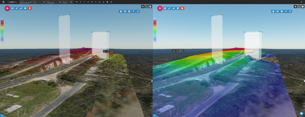
Our latest update extends the power of our SmartData platform to users who process their drone data with DJI Terra or Agisoft Metashape. These powerful processing tools are favored by drone professionals for their precision and flexibility in generating high-quality geospatial data. Now, you can take the outputs from DJI Terra or Agisoft Metashape and effortlessly upload them to the National Drones SmartData platform, allowing you to share data, use our comparison viewer, measurement and inspection tools. This integration is designed to streamline your workflow, enabling you to make the most out of your drone data.

How to Upload Your Processed Data
Uploading your processed data is straightforward. Here’s how you can do it:
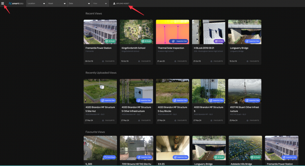
- Log in to Your Account: Access the SmartData platform using your National Drones ID.
- Select Upload Asset: Choose the upload asset button from the top or side menu.
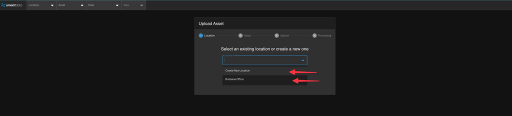
- Select Your Location and Asset: Either create a new location and asset or select an existing one to which you want to upload your dataset to.

- Upload Your Data: Choose the ‘upload pre-processed data’ option. Our platform supports data in JPEG, PNG, and ZIP files containing TMS, CESIUM (B3DM), or CESIUM (PNTS) formats.


- Visualise and Share: Once uploaded, your data is ready to be visualized on our platform. You can easily share it with colleagues or clients, enhancing collaboration and decision-making.
Why This Matters
The integration with DJI Terra and Agisoft Metashape allows you to leverage the full potential of your drone data. Whether you’re monitoring construction progress, conducting agricultural surveys, or inspecting infrastructure, our SmartData platform provides a centralized hub for visualizing and sharing your data. This not only saves time but also ensures that your insights are readily accessible and actionable.
Looking Ahead
At National Drones, we’re committed to continuously enhancing our platform to meet the needs of our users. This update is just one of the many ways we’re working to make drone data more accessible and useful for professionals around the world. We’re excited to see how our users will leverage this new functionality to elevate their drone operations. Stay tuned for more updates, and as always, fly safe!
To get a demo of SmartData – feel free to contact us using the form below