Drones in Energy
Powerline patrols, solar panel inspections, wind turbine surveys, and infrastructure monitoring for energy companies across Australia.
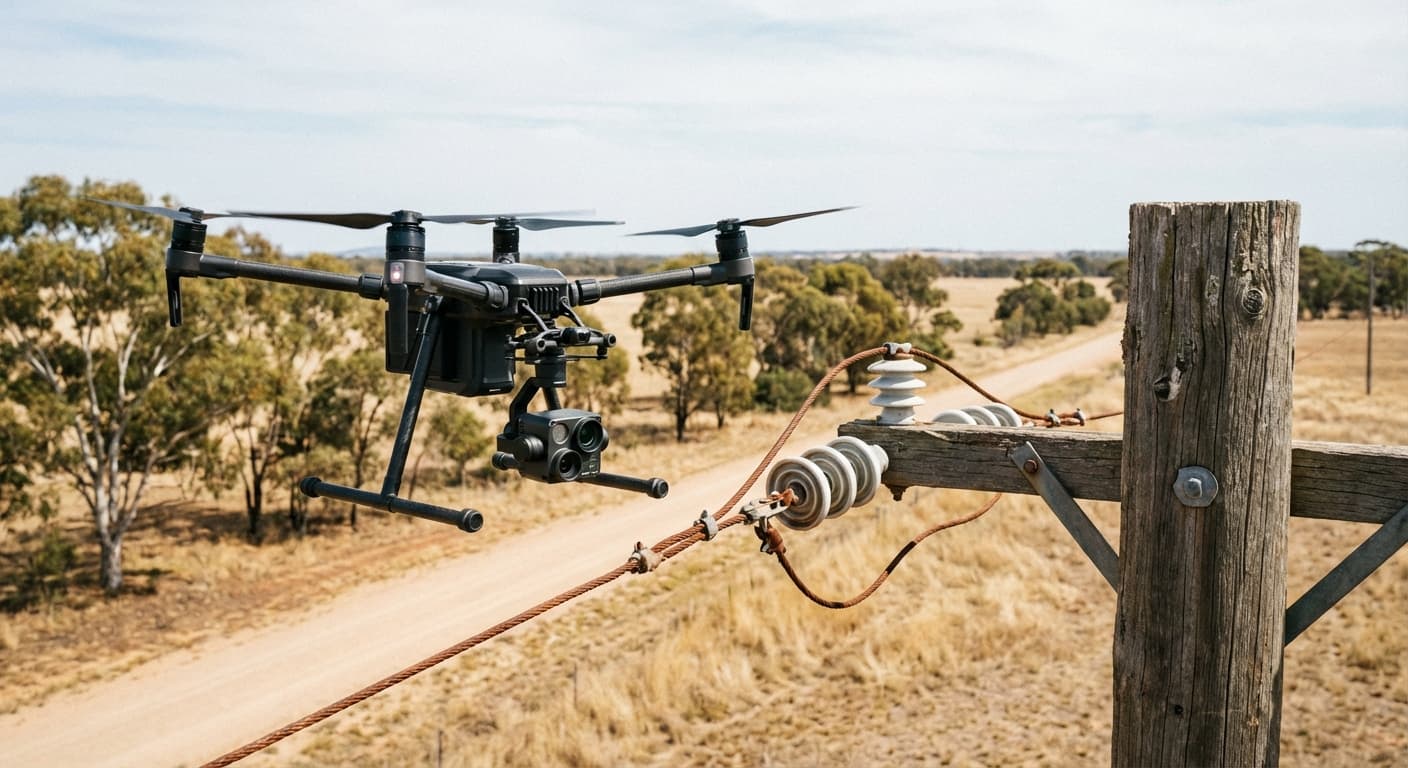
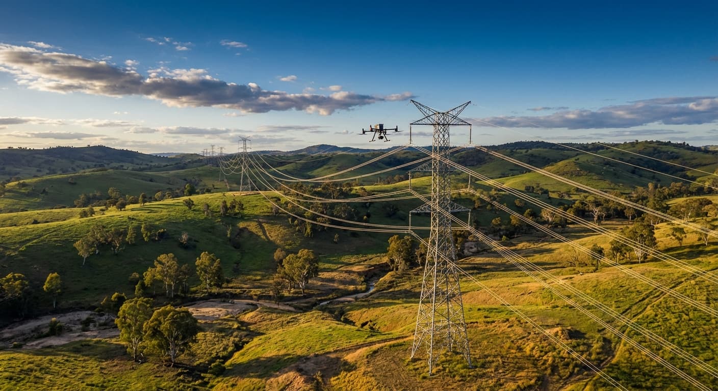
Powerline Inspections
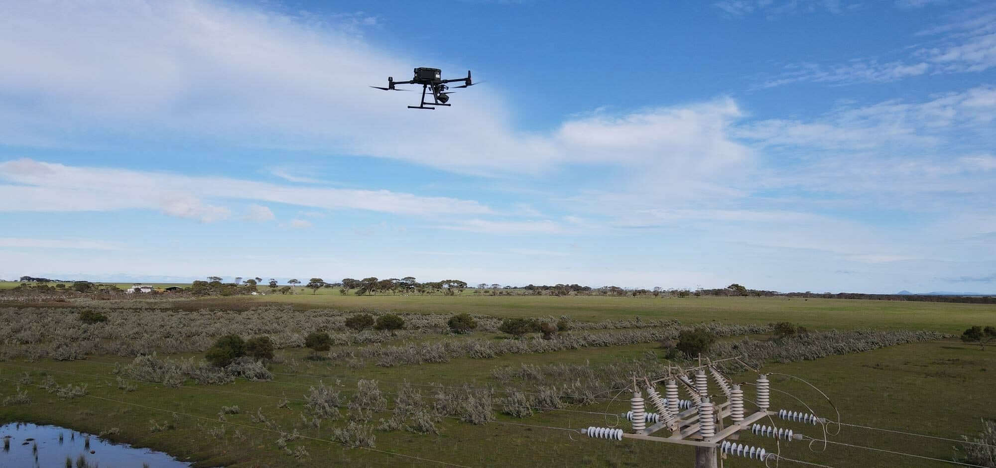
Drones inspect distribution and transmission powerline networks at scale, capturing high-resolution visual and thermal imagery of every pole, conductor, insulator, and fitting. Thermal imaging identifies overheating connections, failing insulators, and unbalanced loads before they cause outages or fires. LiDAR measures conductor clearances and vegetation proximity with centimetre accuracy, supporting vegetation management programs and compliance reporting.
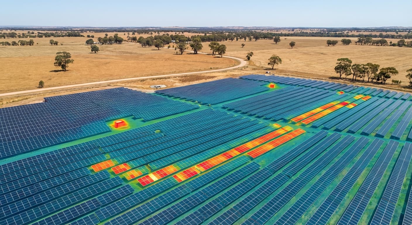
Solar Panel Inspections
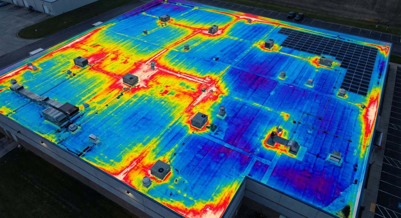
Thermal drone inspections are the standard method for identifying underperforming solar panels at scale. A drone-mounted thermal camera captures radiometric data across the entire array, revealing cell hotspots, bypass diode failures, string faults, and connection problems that are invisible to visual inspection. For utility-scale solar farms, drones inspect thousands of panels in a single day — enabling targeted maintenance rather than blanket replacement.
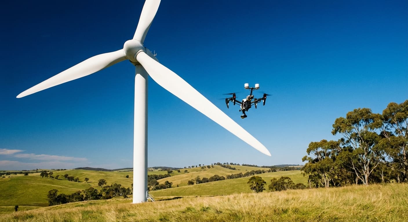
Wind Turbine Inspections
Wind turbine blades operate in extreme conditions and develop surface defects — erosion, lightning strike damage, cracks, and leading edge deterioration — that require regular monitoring. Drones fly close to each blade, capturing high-resolution imagery from hub to tip without requiring rope access teams or expensive crane platforms. This is safer, faster, and produces a more complete visual record.
Water Infrastructure & Pipeline Monitoring
Water utilities use drones to monitor treatment plants, reservoirs, pipelines, and dam infrastructure. Thermal imaging detects underground pipe leaks and dam wall seepage. Aerial photogrammetry creates 3D models of treatment plant assets for condition assessment and maintenance planning. Our work with Gippsland Water and Western Water demonstrates how drone data supports comprehensive asset management for water utilities.
Services for Energy
Drone capabilities that support energy generation, transmission, and distribution infrastructure.
Inspections
Visual inspections of powerlines, towers, substations, and generation assets without shutdowns or elevated access.
Thermal Inspections
Thermal imaging for solar panel fault detection, electrical hotspot identification, and equipment condition monitoring.
LiDAR Surveys
Conductor clearance measurement, vegetation proximity assessment, and corridor mapping for powerline networks.
Surveying & Mapping
Large-area surveys for solar farm planning, wind farm site assessment, and pipeline corridor mapping.
Energy Insights
Learn more about how drones are used in the energy industry.
Energy Case Studies
See how we have delivered for energy and utility companies across Australia.
Infrastructure Engineering
Aurecon & Snowy Hydro
National Drones conducted comprehensive bridge inspections for Aurecon and Snowy Hydro, capturing high-resolution LiDAR and photogrammetry data across 38 bridges in NSW and ACT.
Rail Infrastructure
Aurecon (on behalf of Sydney Trains)
National Drones and Aurecon inspected 3,818 rail assets across Sydney's network using drone photogrammetry and LiDAR, covering 438 kilometres of rail corridor.
Utilities
Western Australian Utility Provider
National Drones revolutionised utility sector inspection programs by conducting drone inspections of 25,000 distribution poles, improving safety and efficiency.
Higher Education
Edith Cowan University & BGIS
National Drones assists BGIS and Edith Cowan University in delivering operational efficiencies and improving building management through safe, rapid drone-based structural inspections.
Frequently Asked Questions
- How are drones used in the energy sector?
- Drones in the energy sector are used for powerline inspections (distribution and transmission), solar panel thermal inspections, wind turbine blade inspections, pipeline corridor surveys, substation and switchyard inspections, dam wall monitoring, and vegetation management assessments. They provide faster, safer, and more detailed data than traditional inspection methods.
- How much does a drone powerline inspection cost?
- Drone powerline inspections typically cost $50-$150 per structure for distribution poles, or $500-$2,000 per kilometre for transmission corridor surveys. Large-scale programs inspecting thousands of structures benefit from significant volume pricing. Our 25,000 power pole program demonstrated the economics at scale.
- Can drones detect faults on solar panels?
- Yes. Thermal drone inspections are the most effective method for detecting solar panel faults. Thermal cameras identify cell hotspots, bypass diode failures, string faults, junction box overheating, and PID (Potential Induced Degradation). A drone can thermally inspect thousands of panels in a single day — faults that would be virtually impossible to find visually.
- How do drones inspect wind turbines?
- Drones fly close to wind turbine blades, nacelles, and towers capturing high-resolution imagery of the surface. This reveals blade erosion, lightning strike damage, cracks, delamination, and leading edge deterioration. The turbine is stopped during inspection, and the drone captures every blade from hub to tip — far safer than rope access and producing a more comprehensive record.
- What is the advantage of drone inspections for utilities?
- The key advantages are safety (removing workers from energised and elevated environments), speed (inspecting hundreds of assets per day versus dozens), data quality (high-resolution imagery and thermal data for every asset), and cost (40-70% less than traditional inspection methods at scale). Drone data also integrates directly into GIS and asset management systems.
Ready to See What Drones Can Do?
Tell us about your project and we'll send you a tailored proposal — most quotes are turned around within 24 hours.