SmartData Software
Empower your workforce and manage asset inspections with cloud-based digital visualisation and interaction tools.
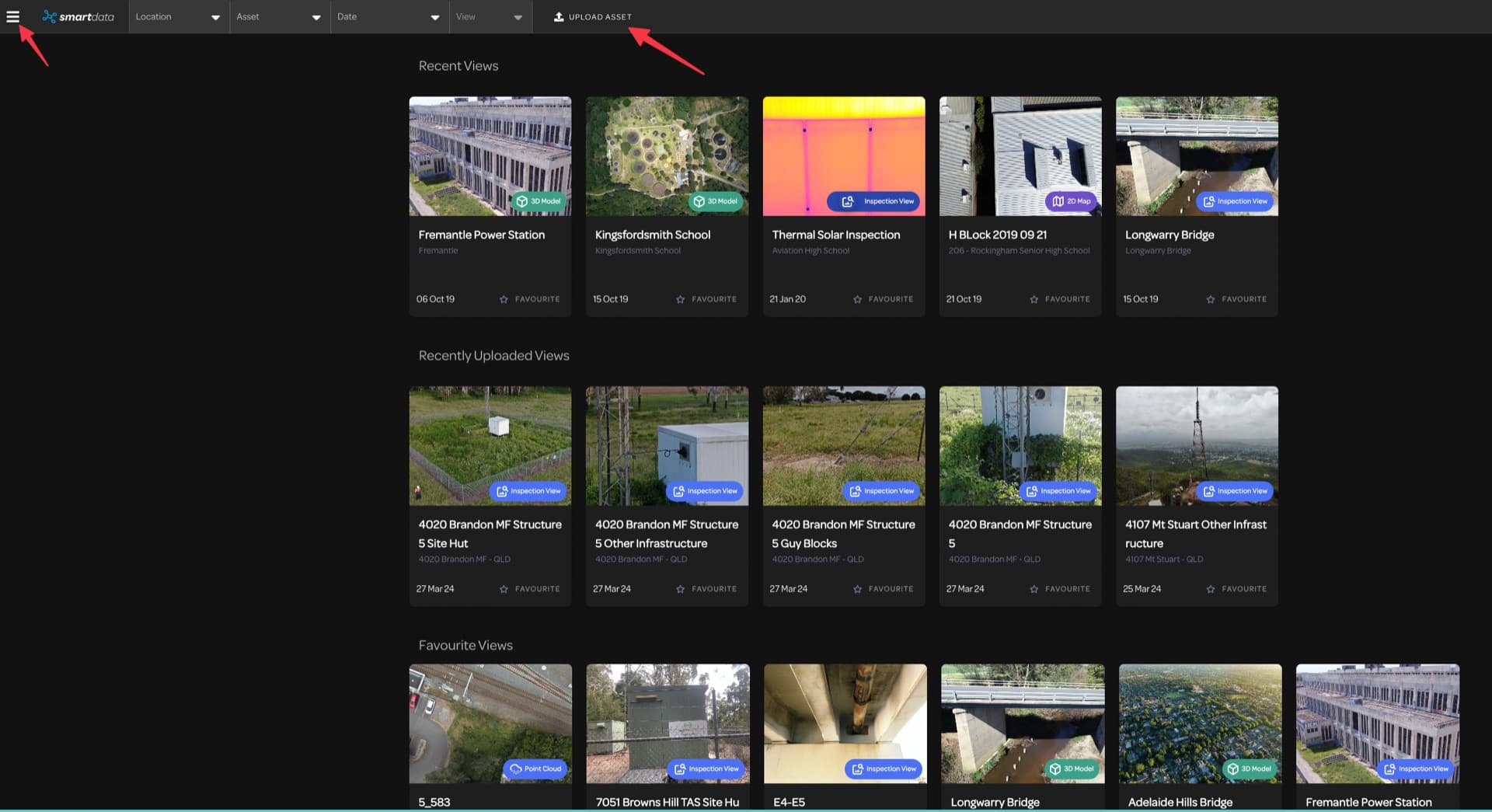
Our Software Suite
Purpose-built tools for asset management and data visualisation in telecommunications, energy, and mining.
2D Mapping
Accurate orthomosaic land mapping with high-resolution imagery. View and explore vast areas with resolution down to 3cm per pixel.
3D Modelling
Dynamic modelling for holistic visualisation. Create interactive, photorealistic 3D models from hundreds of high-resolution images.
Inspection Viewer
Interactive annotation for clear communication. Examine vertical assets in detail with high-resolution images and thermal overlays.
Platform Features
The SmartData platform provides enterprise-grade tools for managing and analysing drone-captured data.
Multiple Views
Interactive orthomosaic, 3D, and CAD viewers enable examination from multiple angles with spatial data for accurate digital measurements.
Data Sharing
Web-based collaborative platform allowing teams to share data with stakeholders, manage permissions, and generate PDF reports.
Time Series Monitoring
Compare current and previous imagery side-by-side to track asset condition changes over time and identify issues proactively.
Cloud-Based Access
Access your data securely from any desktop device with customisable user permissions for multiple stakeholders.
Built for Accuracy
Delivers powerful, transferable information for improved decision-making and return on investment across your operations.
Secure Storage
Reliable data storage with secure retrieval capabilities, purpose-built for telecommunications, energy, and mining sectors.
Want to See SmartData in Action?
Book a demo of our SmartData software and discover how it can transform your asset management workflows.
Ready for Lift Off?
Get in touch with our team to discuss how our drone services can support your next project.