Drones in Mining
8 February 2023
Drones in Mining
The Australian mining industry has been an early and enthusiastic adopter of drone technology. From exploration through to rehabilitation, drones are delivering safer, faster, and more accurate data across every stage of the mining lifecycle.
Why Mining Needs Drones
Mining operations present unique challenges that make drone technology particularly valuable:
- Vast areas to survey and monitor, often in remote locations
- Hazardous environments including open pits, underground entries, stockpiles, and processing plants
- Constant change as pits deepen, dumps grow, and operations evolve
- Strict regulatory requirements for survey accuracy, environmental monitoring, and safety reporting
- Pressure to reduce costs while maintaining or improving operational efficiency
Traditional methods of addressing these challenges -- manned aircraft, ground-based survey crews, and manual inspections -- are expensive, time-consuming, and often put workers at risk. Drones offer a better way.
Key Applications
Stockpile Measurement
Accurate measurement of stockpile volumes is critical for inventory management, reconciliation, and financial reporting. Drones can survey stockpiles in minutes, producing accurate 3D models from which volumes are calculated.
Compared to traditional survey methods, drone stockpile surveys are:
- Faster -- A stockpile that takes a ground crew half a day can be surveyed by drone in 15 minutes
- Safer -- No need for surveyors to walk on or around active stockpiles
- More accurate -- Dense point clouds capture the true surface shape rather than interpolating between sparse survey points
- More frequent -- Lower cost and faster turnaround allow more regular measurements
Pit and Dump Surveys
Drones are used to produce regular topographic surveys of open pit mines and waste dumps. These surveys support:
- Volume calculations for material movement
- Compliance with mine plans
- Geotechnical monitoring of pit walls and dump faces
- Design verification for benches, ramps, and drainage
Blast Planning and Fragmentation Analysis
Pre-blast drone surveys provide accurate bench geometry for blast design. Post-blast surveys capture fragmentation data that can be analysed to optimise future blast designs, improving downstream processing efficiency.
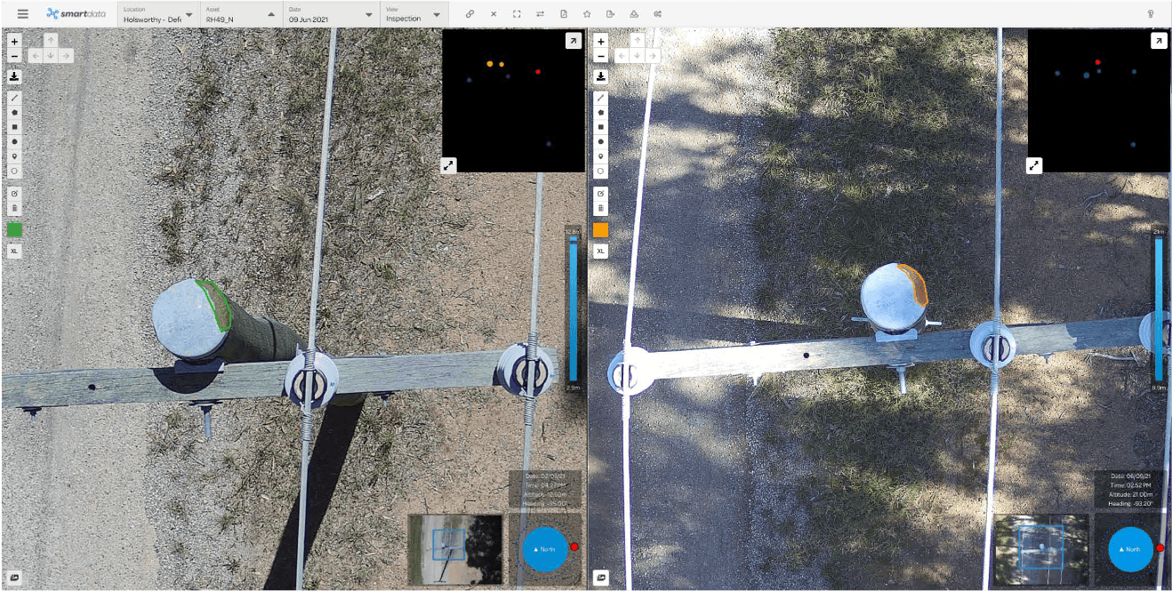
Infrastructure Inspection
Mining operations involve extensive infrastructure that requires regular inspection, including:
- Conveyors and processing plants
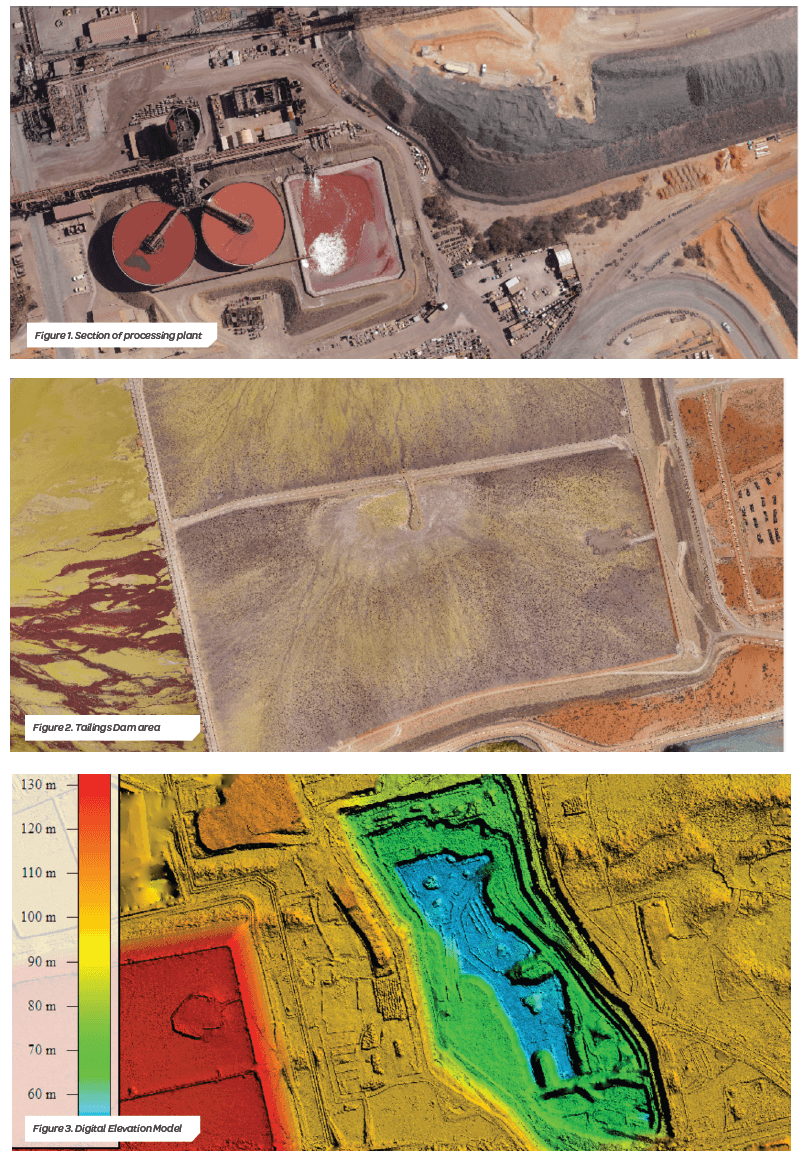
- Tailings storage facilities
- Water management structures
- Power lines and communications towers
- Haul roads and access tracks
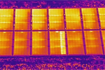
Drones equipped with visual, thermal, and LiDAR sensors can inspect these assets more quickly and safely than traditional methods.
Environmental Monitoring
Mining companies have regulatory obligations to monitor and manage environmental impacts. Drones support this through:
- Vegetation monitoring and rehabilitation tracking
- Erosion and sediment control assessment
- Water quality sampling support (identifying areas of concern for ground crews)
- Dust monitoring and source identification
- Wildlife surveys
Exploration
During the exploration phase, drones are used for:
- Magnetic and radiometric surveys using lightweight sensor payloads
- Terrain mapping for access planning
- Photographic documentation of exploration targets
- Environmental baseline surveys
Safety and Security
Drones enhance mine site safety by:
- Inspecting areas that are unsafe for personnel to access
- Providing aerial situational awareness during emergency response
- Monitoring exclusion zones and restricted areas
- Documenting incidents and near-misses from a safe vantage point
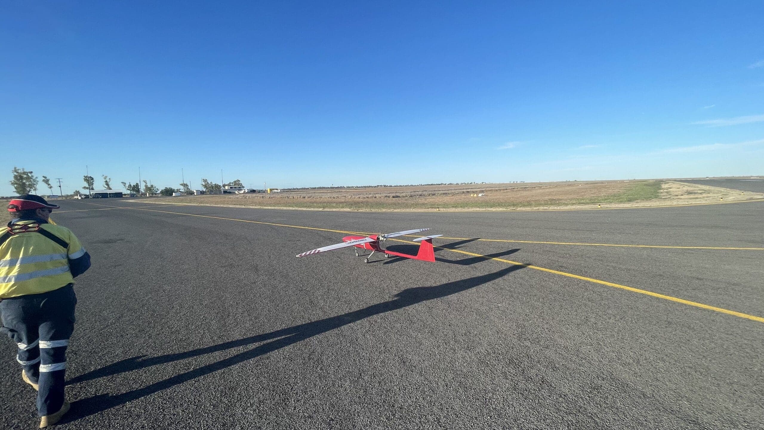
Technology
National Drones deploys a range of drone platforms and sensors to meet the diverse requirements of mining operations:
- Multi-rotor drones for detailed inspections and small-area surveys
- Fixed-wing drones for large-area mapping and corridor surveys
- VTOL (Vertical Take-Off and Landing) drones combining the versatility of multi-rotors with the range and speed of fixed-wings
- RTK/PPK GPS for survey-grade positional accuracy
- LiDAR sensors for accurate terrain mapping in vegetated areas
- Thermal cameras for infrastructure inspections and environmental monitoring
- Multispectral cameras for vegetation health assessment
Integration with Mine Systems
Drone data is most valuable when integrated with existing mine systems and workflows. National Drones delivers data in formats compatible with:
- Mine planning software (Deswik, Surpac, Vulcan, MineSight)
- GIS platforms (ArcGIS, QGIS)
- Asset management systems
- Volume reconciliation tools
- Environmental monitoring databases
Working with National Drones
National Drones has extensive experience supporting mining operations across Australia. We understand the operational requirements, safety standards, and data specifications that mining companies demand.
Our services can be delivered as one-off projects or ongoing programs, with regular survey schedules tailored to your operational needs.
Contact us to discuss how drones can improve your mining operations.