Drones in Agriculture
22 March 2023
Drones in Agriculture
Australian agriculture is being transformed by drone technology. From broadacre cropping to horticulture and livestock management, drones are providing farmers and agronomists with data and capabilities that were previously unavailable or prohibitively expensive.
Key Applications
Crop Health Monitoring
Drones equipped with multispectral cameras can capture imagery across multiple light wavelengths, including near-infrared, which is invisible to the human eye. This data is used to calculate vegetation indices such as NDVI (Normalised Difference Vegetation Index), which indicate the health and vigour of crops.
By identifying areas of stress early, farmers can:
- Investigate and address problems before they spread
- Target inputs to areas that need them most
- Reduce waste by avoiding blanket applications of fertiliser or chemicals
- Monitor the effectiveness of interventions over time
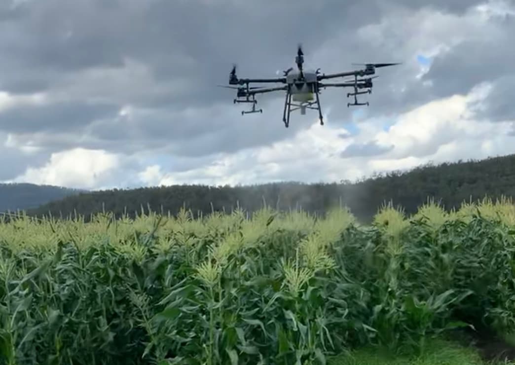
Precision Spraying
Agricultural drones equipped with spray systems can apply herbicides, pesticides, fungicides, and liquid fertilisers with high precision. Benefits include:
- Targeted application -- Spray only where needed, reducing chemical use by up to 90 per cent compared to blanket applications
- Access -- Reach waterlogged paddocks, steep terrain, and areas inaccessible to ground rigs
- Speed -- Cover areas quickly when timing is critical, such as during pest outbreaks
- Safety -- Reduce operator exposure to chemicals
Crop Mapping and Planning
Drone-captured imagery can be processed into detailed maps that support farm planning and management:
- Paddock boundary mapping
- Soil variation mapping
- Drainage and irrigation planning
- Yield prediction and harvest planning
- Historical comparison of crop performance
Livestock Monitoring
Drones are increasingly used to support livestock operations:
- Mustering -- Drones can locate and move stock across large properties more efficiently than motorbikes or horses in certain terrain
- Health checks -- Aerial observation can identify animals that are injured, sick, or isolated
- Fence and water inspection -- Quick aerial checks of fencing and water infrastructure across large properties
- Counting -- Accurate stock counts from aerial imagery
Irrigation Management
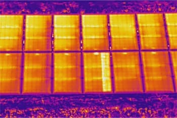
Thermal and multispectral imagery from drones can reveal:
- Areas of water stress before visual symptoms appear
- Irrigation system faults such as blocked nozzles or broken pipes
- Variations in soil moisture across a paddock
- Opportunities to improve irrigation efficiency and reduce water use
Planting and Seeding
Drone seeding is an emerging application that uses drones to distribute seeds, particularly for:
- Cover crop establishment
- Reforestation and revegetation
- Seeding in areas that are difficult to access with ground equipment
- Rapid re-seeding after flood or fire events
Benefits for Farmers
Better Decisions
Drone data gives farmers a comprehensive, up-to-date picture of their property. This information supports better decision-making about where and when to apply inputs, when to irrigate, and how to manage variability across the farm.
Cost Savings
By targeting inputs precisely, farmers can reduce the volume of seed, fertiliser, and chemicals used. Early detection of problems prevents small issues from becoming large, expensive ones.
Time Efficiency
Drones can cover large areas quickly, providing data that would take days to collect by walking or driving. This is particularly valuable during busy periods such as planting and harvest.
Environmental Benefits
Precision agriculture practices enabled by drones reduce the environmental impact of farming by minimising chemical runoff, reducing water waste, and supporting more sustainable land management.
Technology
National Drones operates a range of agricultural drone platforms, including:
- Multispectral mapping drones for crop health assessment and vegetation indexing
- Thermal imaging drones for irrigation and water stress analysis
- Spray drones for precision application of liquids
- High-resolution RGB drones for general mapping and monitoring
Our data processing pipeline delivers actionable outputs including NDVI maps, crop health reports, prescription maps for variable-rate application, and comprehensive farm monitoring dashboards.
Working with National Drones
Whether you are a broadacre farmer, a horticultural grower, a viticulturist, or a pastoral operator, National Drones can help you get more from your land with less input.
Contact us to discuss how drone technology can support your agricultural operations.