Drone Surveying and Mapping
28 June 2023
Drone Surveying and Mapping
Drone surveying has become one of the most impactful applications of commercial drone technology. By combining high-resolution cameras, precision GPS, and advanced processing software, drones can produce survey-grade geospatial data that was previously only achievable through expensive manned aircraft or time-consuming ground-based methods.
How Drone Surveying Works
Drone surveying follows a systematic process:
1. Project Planning
Every survey begins with detailed planning that defines:
- The survey area boundaries
- Required accuracy and resolution
- Ground control point (GCP) requirements
- Flight altitude and image overlap settings
- Coordinate system and datum
- Deliverable specifications
2. Ground Control
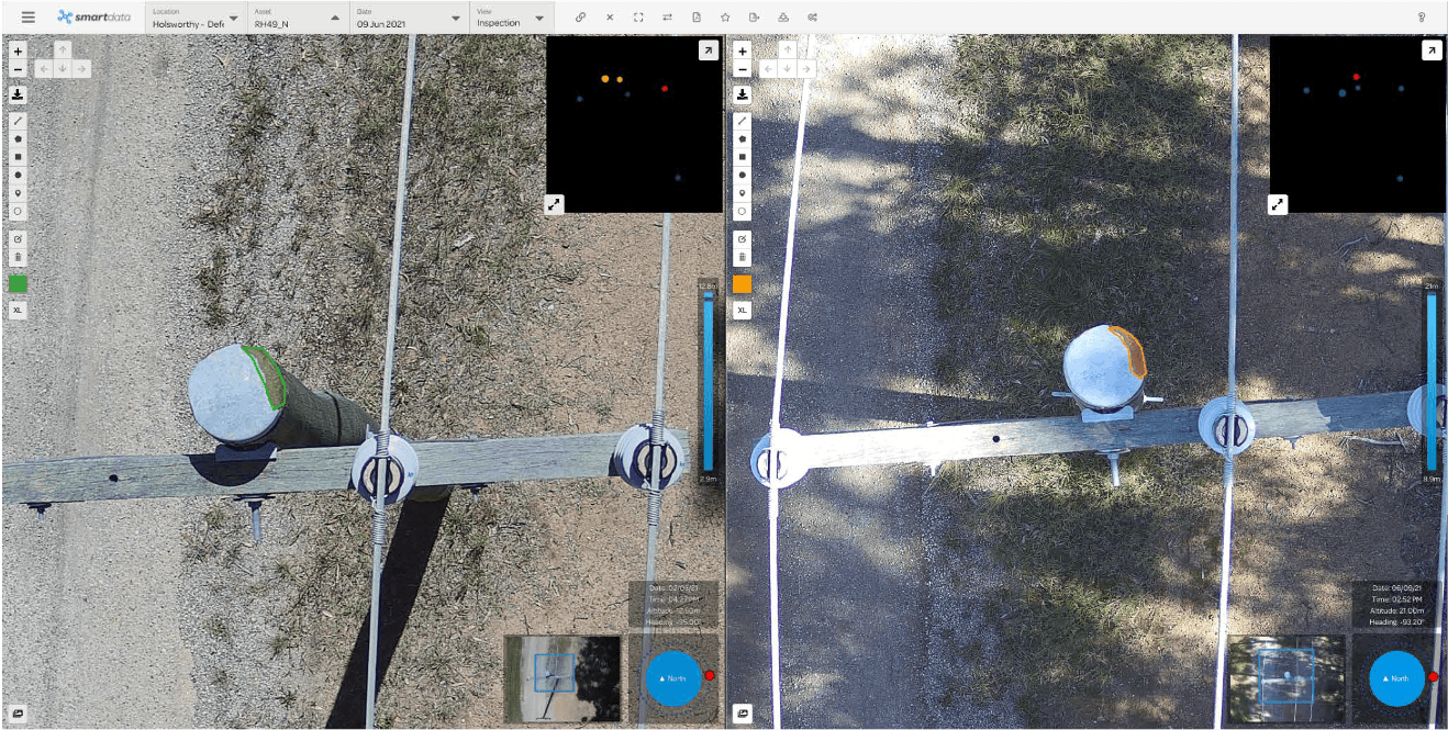
For survey-grade accuracy, ground control points are established across the site using high-precision GNSS equipment. These known reference points allow the photogrammetry software to accurately georeference the drone imagery.
Alternatively, drones equipped with RTK (Real-Time Kinematic) or PPK (Post-Processed Kinematic) GPS can achieve centimetre-level accuracy with reduced reliance on GCPs.
3. Data Capture
The drone flies pre-programmed flight paths, capturing overlapping photographs at precise intervals. Typical settings include:
- Front overlap: 75 to 85 per cent
- Side overlap: 65 to 75 per cent
- Flight altitude: 40 to 120 metres depending on required resolution
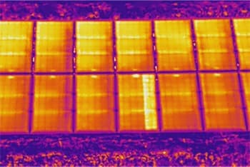
- Camera: High-resolution RGB, multispectral, or thermal depending on the application
4. Data Processing
The captured images are processed using photogrammetry software that:
- Identifies common points across overlapping images
- Reconstructs the 3D geometry of the scene
- Generates dense point clouds, surface models, and orthomosaics
- Applies coordinate system transformations and quality checks
5. Deliverable Production
Processed data is used to produce the required survey deliverables, which may include any combination of the outputs described below.
Survey Deliverables
Orthomosaic Maps
Geometrically corrected aerial imagery with uniform scale throughout. Accurate measurements can be taken directly from an orthomosaic. Resolution is typically 1 to 5 centimetres per pixel depending on flight altitude.
Digital Terrain Models (DTM)
Bare-earth surface models with vegetation and structures removed. Essential for engineering design, earthworks planning, drainage analysis, and contour generation.
Digital Surface Models (DSM)
Surface models representing the top of all features including buildings, vegetation, and stockpiles. Used for volumetric calculations, visibility analysis, and site overview.
Contour Maps
Topographic contour lines generated from the terrain model at specified intervals. Contours are produced in standard CAD or GIS formats for integration with design workflows.
3D Point Clouds
Dense three-dimensional point data representing the surveyed area. Point clouds can be classified, measured, and analysed in specialised software or exported for use in BIM and CAD environments.
Volume Calculations
Cut, fill, and stockpile volumes calculated from surface models. Drone surveys enable rapid, accurate volume measurements that support earthworks management, inventory control, and reconciliation.
Cross-Sections and Profiles
Elevation profiles extracted along defined alignments for road design, channel surveys, or corridor analysis.
Accuracy
The accuracy of drone surveys depends on the equipment and methodology used:
- Without ground control or RTK: 1 to 3 metres horizontal, 2 to 5 metres vertical
- With ground control points: 2 to 5 centimetres horizontal and vertical
- With RTK/PPK and ground control: 1 to 3 centimetres horizontal and vertical
These accuracy levels are sufficient for most engineering, construction, and land management applications.
Applications
Construction and Civil Engineering
- Topographic surveys for design
- Earthworks monitoring and volume tracking
- Progress reporting
- As-built surveys
Mining
- Pit and dump surveys
- Stockpile volume measurement
- Haul road monitoring
- Rehabilitation surveys
Land Development
- Site surveys for subdivision design
- Contour and drainage analysis
- Boundary and feature surveys
- Environmental impact assessments
Infrastructure
- Road and rail corridor surveys
- Pipeline route surveys
- Dam and reservoir surveys
- Telecommunications site surveys
Environmental and Natural Resource Management
- Coastal erosion monitoring
- Wetland and habitat mapping
- Flood modelling support
- Vegetation classification
Advantages of Drone Surveying
- Speed -- Survey areas in hours that would take days or weeks by ground methods
- Safety -- No need for personnel in hazardous locations
- Data density -- Millions of points per survey versus hundreds with traditional methods
- Visual context -- High-resolution imagery alongside survey data
- Cost effective -- Lower mobilisation costs and faster completion
- Repeatability -- Consistent methodology allows accurate change detection between surveys
Working with National Drones
National Drones provides professional drone surveying services across Australia. We operate survey-grade drone platforms with RTK GPS and deliver data that meets engineering and survey standards.
Contact us to discuss your surveying and mapping requirements.