Drone Inspections
5 January 2023
Drone Inspections
Drone inspections have become a standard practice across industries that rely on regular assessment of physical assets. By using drones equipped with high-resolution cameras, thermal sensors, and other specialised payloads, organisations can inspect their assets more safely, more frequently, and with greater detail than traditional methods allow.
Why Drone Inspections?
Traditional inspection methods often involve:
- Working at height using scaffolding, rope access, or elevated work platforms
- Shutting down equipment or infrastructure during inspection
- Deploying helicopters or manned aircraft for aerial access
- Sending personnel into hazardous environments
These methods are expensive, time-consuming, and carry significant safety risks. Drone inspections address each of these challenges.
Safety
Drones keep inspection personnel on the ground, eliminating the risks associated with working at height, in confined spaces, or near energised equipment. This is the single most important advantage of drone inspections.
Speed
Drones can access and inspect assets in minutes that might take hours or days to reach using traditional methods. Reduced inspection time also means less downtime for the asset being inspected.
Detail
Modern drone cameras and sensors capture data at resolutions and in spectrums that exceed what the human eye can see. High-resolution visual imagery reveals fine surface defects, while thermal imaging detects heat anomalies that indicate hidden faults.
Cost
By reducing the need for specialised access equipment, large crews, and extended shutdowns, drone inspections deliver significant cost savings. Lower per-inspection costs also make more frequent inspections economically viable, improving overall asset management.
Documentation
Every drone inspection produces a comprehensive digital record -- geotagged imagery, thermal data, and 3D models that can be stored, reviewed, and compared over time. This documentation supports maintenance planning, regulatory compliance, and warranty claims.
Types of Drone Inspections
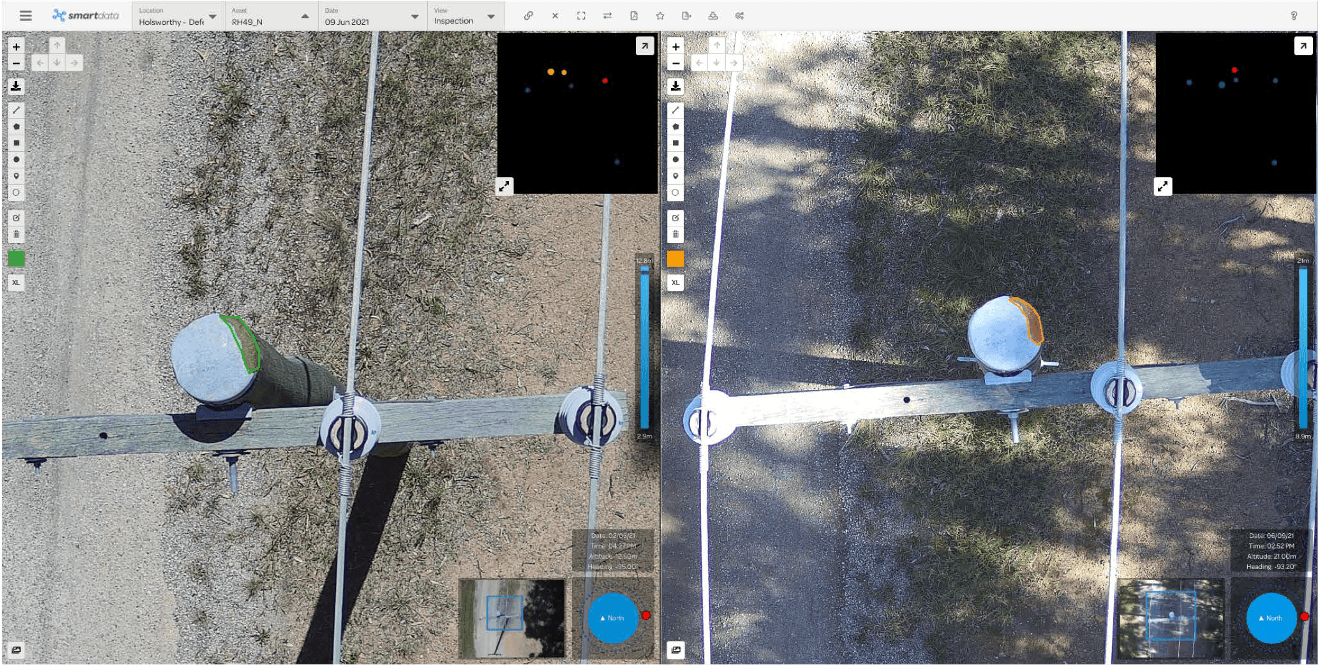
Visual Inspections
High-resolution cameras capture detailed imagery of assets from multiple angles. Visual inspections identify surface defects such as cracks, corrosion, wear, damage, and deterioration.
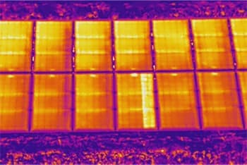
Thermal Inspections
Thermal cameras detect temperature anomalies that indicate electrical faults, moisture intrusion, insulation failures, and overheating components. Thermal inspections are particularly valuable for electrical infrastructure, solar panels, buildings, and industrial equipment.
LiDAR Inspections
LiDAR sensors produce accurate 3D models of assets and their surroundings, enabling precise measurement of clearances, deformation, and structural geometry.
Multispectral Inspections
Multispectral cameras capture imagery across multiple light wavelengths, revealing conditions invisible to standard cameras. Applications include vegetation health assessment, material identification, and corrosion detection.
Industries and Applications
Energy
- Solar panel thermal inspections
- Powerline and substation surveys
- Wind turbine blade inspections
- Oil and gas pipeline monitoring
- Cooling tower and stack inspections
Infrastructure
- Bridge inspections (deck, piers, bearings, expansion joints)
- Dam and spillway assessments
- Road and rail corridor surveys
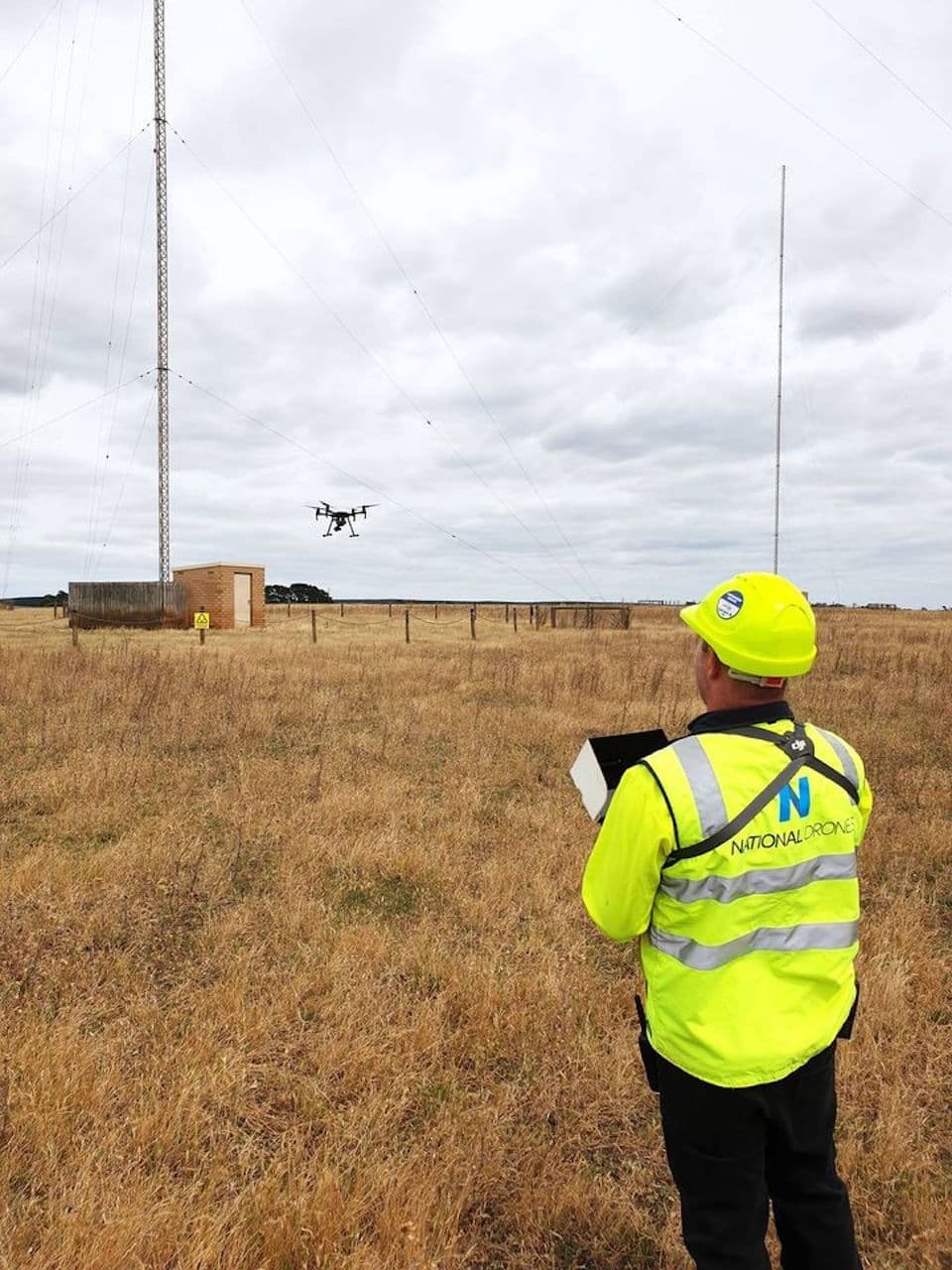
- Telecommunications tower audits
- Water and wastewater infrastructure
Building and Construction
- Roof condition assessments
- Facade inspections
- Construction progress monitoring
- Building envelope thermal surveys
- Heritage and listed building documentation
Mining and Resources
- Conveyor and processing plant inspections
- Tailings storage facility monitoring
- Stockpile measurement
- Ventilation shaft inspections
- Structural integrity assessments
Maritime and Ports
- Ship hull inspections
- Port infrastructure surveys
- Breakwater and seawall condition assessments
- Container yard monitoring
Our Inspection Process
1. Scope and Planning
We work with clients to define the inspection scope, identify specific assets and defects of interest, and plan the drone flights accordingly.
2. Site Assessment
Before every inspection, we conduct a thorough site risk assessment covering airspace, weather, ground hazards, and operational requirements.
3. Data Capture
Our pilots capture systematic, comprehensive imagery of every asset within the scope. We use standardised flight paths and camera settings to ensure consistent, repeatable results.
4. Analysis
Our analysis team reviews the captured data, identifying and classifying defects according to industry standards and client specifications.
5. Reporting
Clients receive a detailed inspection report including annotated imagery, defect locations, severity classifications, and maintenance recommendations.
6. Data Integration
Inspection data can be delivered in formats compatible with asset management systems, GIS platforms, and CMMS software.
Working with National Drones
National Drones provides professional drone inspection services across Australia. We have experience inspecting assets across energy, infrastructure, construction, mining, and environmental sectors.
Our inspection services are backed by:
- CASA-licensed pilots with specialist inspection training
- Industry-leading drone platforms and sensor payloads
- Comprehensive safety management systems
- Full insurance coverage
- Professional reporting and data delivery
Contact us to discuss your inspection requirements.