Broadcast Australia — Tower Inspections
Client: Broadcast AustraliaIndustry: Telecommunications & BroadcastingLocation: Australia-wide
Drone InspectionsVertical Asset SurveysAsset Condition Assessment
Overview
Broadcast Australia delivers DTV services nationally on behalf of the ABC and SBS. The organisation operates 391 sites across Australia and required drone-based inspections to understand asset conditions and plan maintenance effectively.
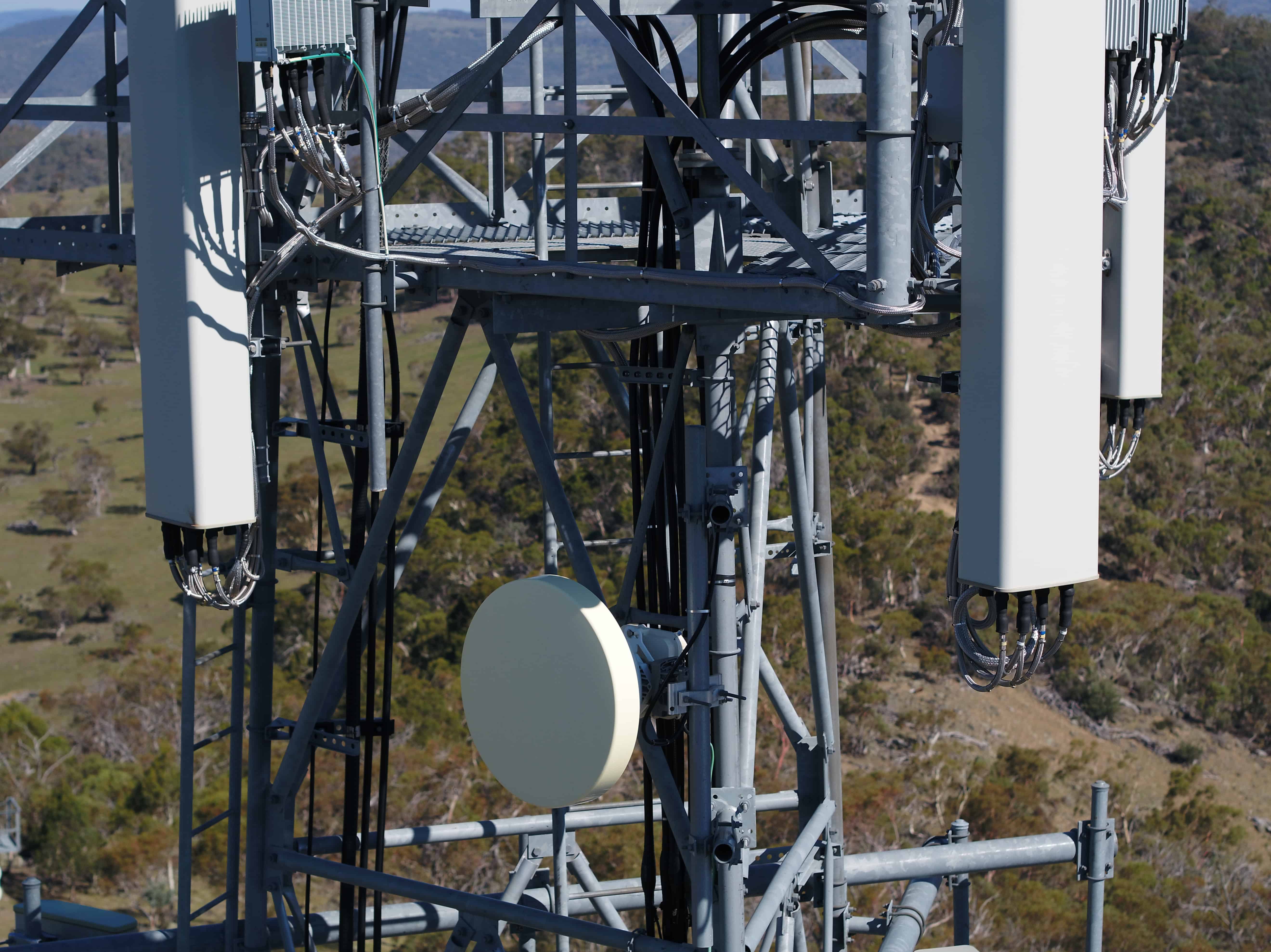
The Challenges
The network includes monopoles, guyed masts, freestanding towers, and hybrid structures ranging from 15 to 204 metres tall. Historically, technicians with rigging qualifications climbed structures for inspections, limiting visibility of external components. Traditional methods proved time-intensive and posed safety risks to personnel.
The Solution
A two-part approach was implemented:
- Vertical flight profile with overlapping imagery enabled complete structure capture from multiple angles
- Custom software developed for desktop navigation, review, annotation, and collaboration on tower assets
The Results
- Operations: Multi-rotor aircraft used; ground testing confirmed performance in high RF interference; CASA approvals obtained for operations exceeding 400 feet
- Inspections: Over 400 vertical assets surveyed since 2018
- Imagery: Ultra-high resolution capture of insulators, guy wires, top loading wires, structures, and site facilities analysed for bolts, paint, and steelwork issues
Benefits
- Increased visibility: Full structure data capture versus select imagery from traditional methods
- Safety: Eliminates climbing risks associated with traditional inspection methods
- Asset lifecycle monitoring: Database building enables condition tracking over time
- No downtime: Eliminates required outages during traditional inspections
- Speed: Drone surveys complete in half to quarter the time of traditional inspections