BHP Olympic Dam — BVLOS Survey
Overview
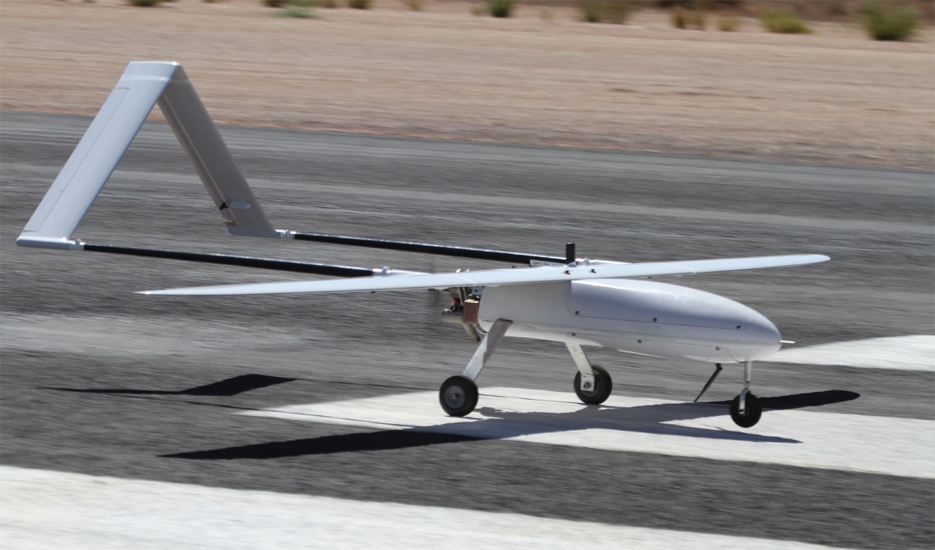
National Drones conducted aerial surveys for BHP to update spatial imagery over a 180km² (18,000 hectare) mine site in South Australia. The operation utilised fixed-wing drone technology operating beyond visual line of sight (BVLOS), representing one of the largest areas ever covered by survey drone in Australia to date.
The Challenges
Traditional large-area aerial surveys relied on full-size manned aircraft with extensive crew and equipment. Manned aircraft operations present challenges including high operational costs, maintenance issues, and weather susceptibility. Remotely piloted aircraft address these constraints while providing cost-effective alternatives.
The Solution
- Survey entire mine lease plus additional areas (200km² total) using fixed-wing drone
- Post-process aerial imagery to create high-resolution orthomosaic, 3D model, point cloud, digital terrain model, and contours
- Extract features for assessment against future planning requirements
Methodology
Flight operations obtained special Civil Aviation Safety Authority approvals for:
- Beyond Visual Line of Sight Operations
- Operations above 400 feet AGL
- Operations from non-controlled aerodrome
Operations conducted at approximately 1,000 feet above ground level, achieving 7cm ground sampling distance per pixel. The site was divided into quadrants with each taking approximately 3 hours of flight time. Total: 8,000 images captured; aircraft covered approximately 1,200km over 12 hours. GNSS receiver achieved approximately 30mm image location accuracy.
The Results
Deliverables included:
- 2D orthomosaic
- 3D digital twin
- Digital Terrain Model
- Digital Surface Model
- Colourised Point Cloud
- Contours
Data integrated into BHP's GIS system for stakeholder use.
Benefits for BHP
- Enhanced spatial register enabling faster decision-making
- Cost efficiencies through regular assessments using drones
- No operational shutdowns required during survey
- 7cm per pixel data quality — superior to traditional methods
- Digital transformation support for BHP's strategy
- Predictive maintenance — shift from scheduled to predictive approach
- Safety risk reduction compared to manned aircraft
- Environmental benefit — uses less than 1% of the fuel of a full-size aircraft