BVLOS
We have the experience and equipment to complete large area BVLOS survey flights
Unlock a new era of efficiency and accuracy in surveying and mapping with National Drones’ specialised drone surveys. Gone are the days of labor-intensive, resource-draining traditional land surveys that involve complex logistics and high costs. Our drone technology not only simplifies the process but enhances the quality and reliability of your data.
Instead of deploying large teams and equipment to traverse expansive areas and remote locations, our advanced drone surveys offer a more efficient, cost-effective alternative. This isn’t merely a change in methodology; it’s a transformation in how you collect and utilize geographical data.
With our drone surveys, you can capture intricate details such as topographical markers, building locations, roads, waterways, hazards, and property boundaries. The benefits are clear: significant time savings, reduced manpower requirements, and minimised equipment and travel costs. All these contribute to a more streamlined and sustainable approach to surveying and mapping.
In summary, our drone surveys offer you a smarter, more economical, and environmentally responsible way to gather and interpret geographical data.
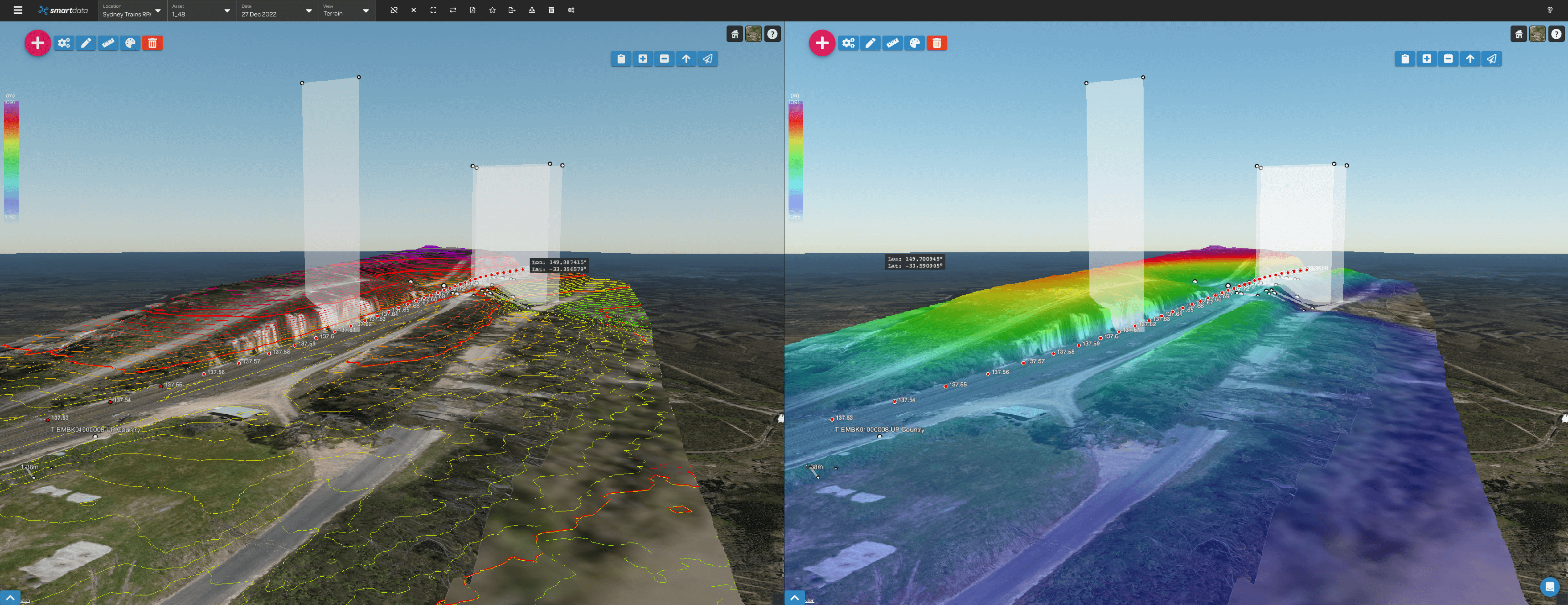
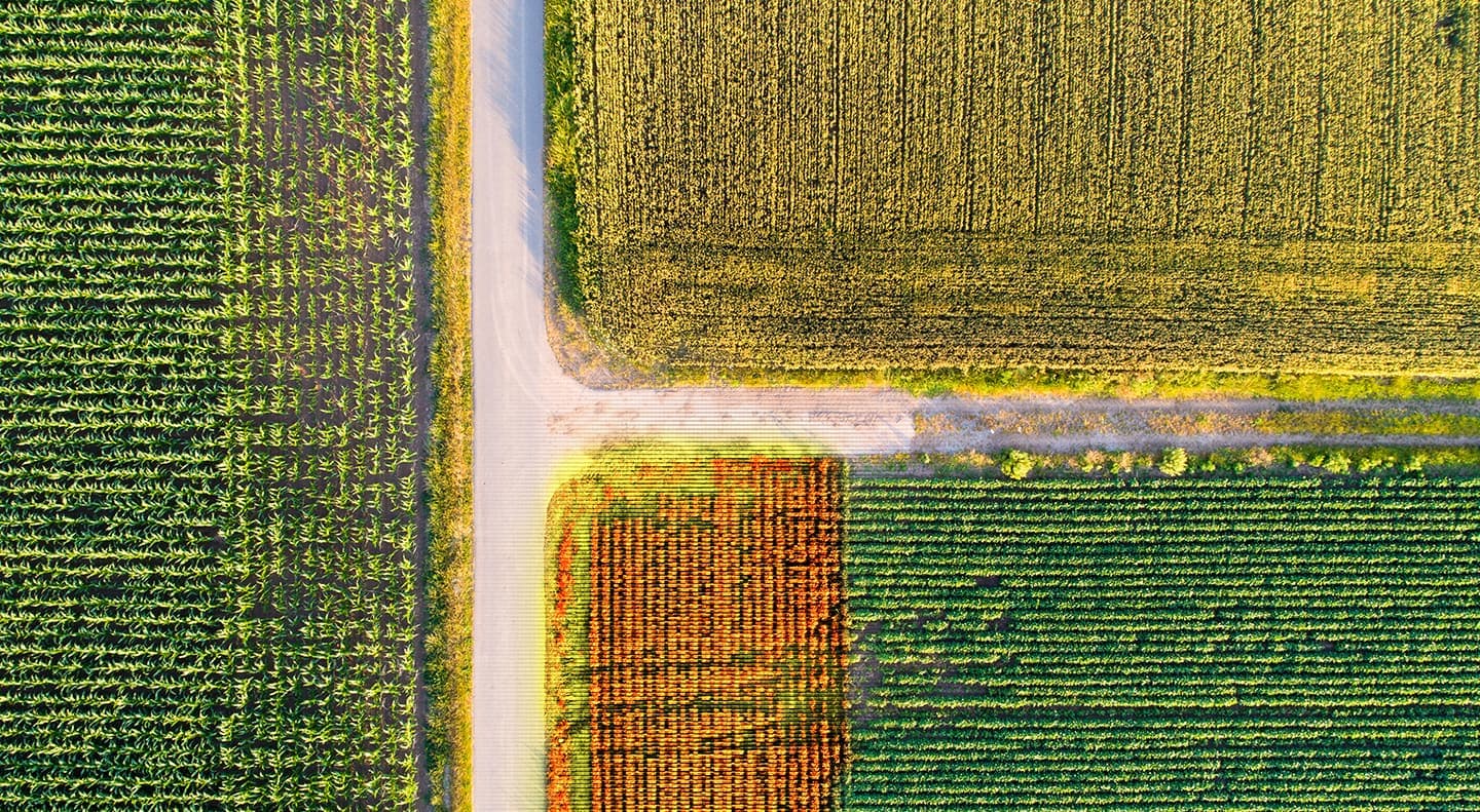
Transform your surveying and mapping initiatives with the power of photogrammetry, a technology that turns aerial images into actionable insights. Unlike traditional methods, photogrammetry provides a more comprehensive view of your project area, capturing all data within a project area to convert to elevation metrics and intricate terrain details.
What does this mean for you? It means a wealth of data that is not only precise but incredibly versatile. Photogrammetry allows for the creation of detailed 2D orthomosaics and 3D models, offering a level of detail that surpasses conventional surveying methods.
Our SmartData software serves as the gateway to this rich aerial data, providing fast, user-friendly access to these advanced mapping solutions. The captured information can be seamlessly integrated into your project plans, making your decision-making process more informed and effective.
In summary, our photogrammetry-based mapping and data capture services elevate your data quality, streamline its application in your workflows, and ultimately, save you time and resources. Step into the future of efficient, detailed, and accurate mapping today with National Drones.
Reimagine the possibilities of surveying with drones that unlock unprecedented levels of safety and access to challenging terrain. Whether you’re dealing with elevated structures, unstable grounds, flood-affected areas, disaster zones, or sensitive wildlife habitats, drones eliminate the risks traditionally associated with these complex survey environments.
The true benefit lies in what this means for your team’s well-being and your project’s efficiency. By leveraging drone technology, you significantly minimize the hazards that come with manual surveys, such as the risk of slips, falls, and other accidents. This not only ensures a safer workplace but also enhances the accuracy and speed of your data collection.
Additionally, the use of drones opens up previously inaccessible or hazardous locations for accurate surveying and mapping. This means you can capture comprehensive data without compromising on safety or quality, enriching your project’s scope and potential outcomes.
In essence, our drone-enabled surveying solutions offer a dual advantage: they mitigate risks while unlocking new opportunities for detailed, accurate surveying.
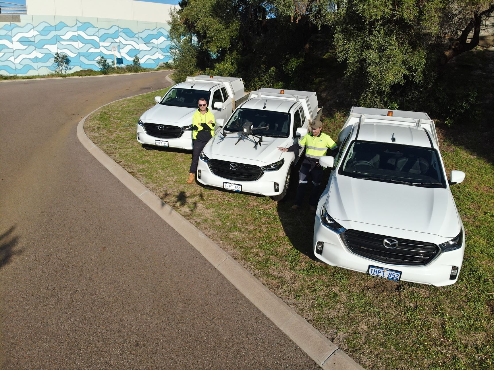
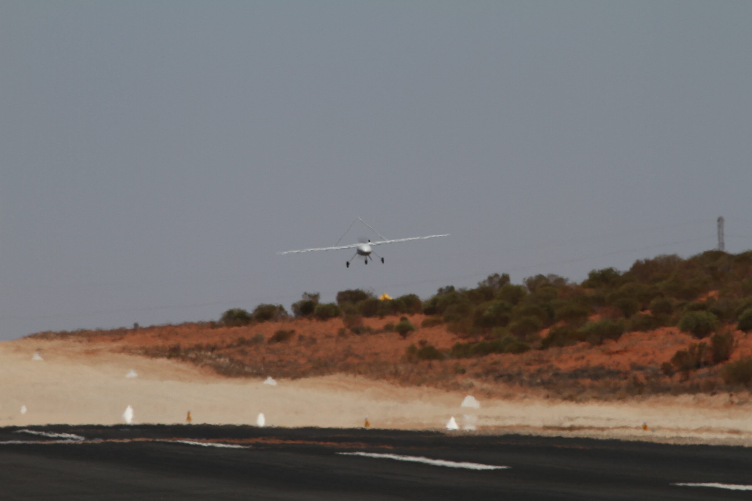
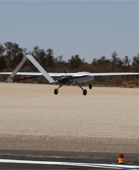
Unlock unparalleled reach and efficiency in large-scale surveying projects with our specialised aircraft, designed for beyond visual line of sight (BVLOS) operations. Traditionally, such extensive surveys required the use of full-sized aircraft, often resulting in high operational costs and logistical complexities.
Our solution dramatically changes this landscape. With a wingspan of 3.5 metres and a flight time of up to 4 hours, our aircraft can cover expansive areas in a single flight, significantly reducing your project’s time and financial footprint.
The real game-changer here is the opportunity this technology opens up. Imagine conducting comprehensive surveys of large-scale agricultural fields, mining sites, or extensive infrastructural projects without the prohibitive costs and logistical hurdles of using full-sized aircraft. Our BVLOS capabilities ensure that you can collect accurate, high-quality data over large areas while keeping operational costs at a fraction of traditional methods.
In summary, our cutting-edge BVLOS surveying solutions redefine what’s possible in large-scale data collection. Experience the future of efficient, affordable, and comprehensive aerial surveying today with National Drones
BHP Olympic Dam