BHP Olympic Dam
Large area survey utilising fixed wing aircraftNational Drones worked with BHP, conducting Drone Surveys enabling them to update their spatial imagery database over their Surface Mine Lease site in South Australia.
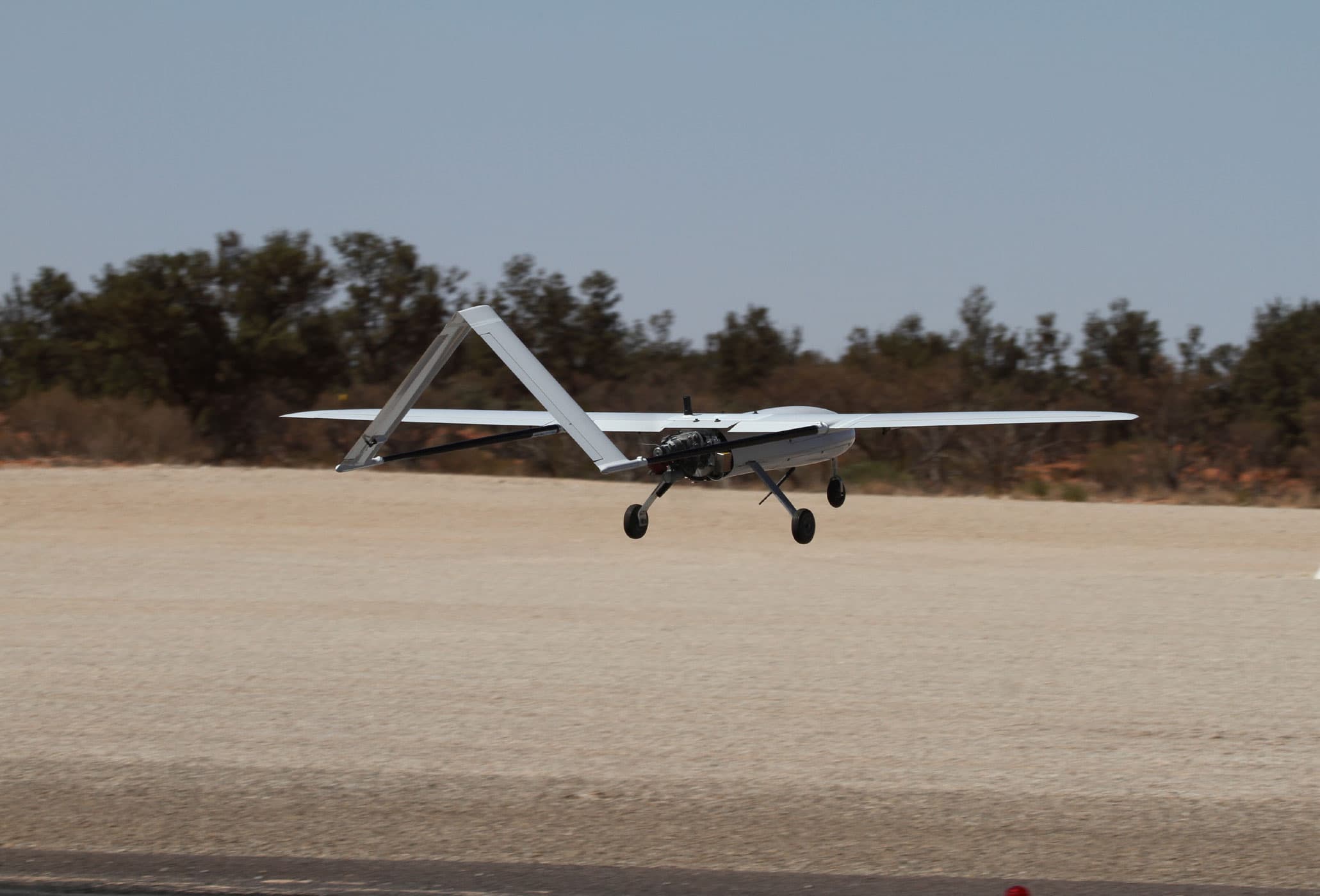
BHP owns and operates a large 180km2 (18,000 hectare) mine site in South Australia. An accurate, up to date spatial register consisting of high resolution imagery, point cloud and mesh products allows relevant stakeholders to have visibility over current mining operations, and future planning to be conducted for an expansion project. National Drones flew a fixed-wing drone beyond visual line of sight (BVLOS) in order to obtain this data.
The survey area was one of the largest ever covered by survey drone in Australia to date.
Other case studies
THE CHALLENGES
Up until the last few years, aerial surveys of this size have traditionally been the realm of full size aircraft, comprising of large sensors and crew to operate them. Recent advancements in remotely piloted aircraft. camera and sensor equipment, and working with relevant stakeholders and regulators now means that what used to be achievable only with a full size, manned aircraft, can now be completed as business as usual surveys.
Manned aircraft can be expensive to operate, have unservicability problems, as well as be susceptible to weather conditions under certain circumstances. Remotely Piloted Aircraft address some of these challenges as well as offer a cost effective way to complete these large surveys.
THE SOLUTION
- Survey to be conducted via drone – A plan was put in place to survey the entire mine lease area, plus additional areas of interest totalling 200km2 utilizing a fixed wing Drone, with the aim of obtaining actionable data with a greater level of detail, and in a more cost effective manner than traditional survey methods
- Desktop asset identification and location – Captured aerial imagery was post-processed to create a high resolution orthomosaic, 3D model, point cloud, digital terrain model and contours of the survey site. From these deliverables, features can be extracted and assessed against future planning requirememts.
METHODOLOGY
Flight operations were conducted utilizing National Drones long range aircraft. For this particular survey, additional approvals and exemptions were sought from the Civil Aviation Safety Authority. These were
- Beyond Visual Line of Site Operations
- Operations above 400 feet AGL
- Operations from and over the movement area of a non-controlled aerodrome.
Flight operations were conducted from the mine sites dedicated aerodrome, which meant that two way communications with inbound regular, scheduled flights needed to take place. The operation was planned at approximately 1000 feet above ground level, giving a ground sampling distance of 7cm per pixel on average. The site was divided into quadrants, with each quadrant taking approximately 3 hours of flying time to complete.
A total of 8,000 images were captured over the site itself. Furthermore, the aircraft itself covered approximately 1200km over a period of 12 hours. A highly accurate GNSS receiver recorded the position of each image event, which was then post processed against a nearby GNSS base station to give image location accuracy of approximately 30mm. A large number of surveyed aerial targets were also utilized to accurately tie the airborne and ground segments of the data together. An orthomosaic image of the site was then produced.
THE RESULTS
A total of more than 8000 images were captured over the site. These images were incredibly detailed with a GSD of 7cm per pixel. From the data collected National Drones produced:
- 2D orthomosaic
- 3D digital twin of the site
- Digital Terrain Model
- Digital Surface Model
- Colourised Point Cloud
- Contours
The deliverables and dataset types were then able to be integrated into BHP’s GIS system for use and review by many stakeholders across the project.
THE BENEFITS FOR BHP

An up-to-date spatial register allowing for faster and more accurate planning and decision making

Cost efficiencies utilising Drone, allows for more regular assessments to take place.

No operational shut-down required to obtain data. Full debrief on-site of survey results

Higher quality of data compared to traditional methods of mapping (GSD of 7cm per pixel)

Forms part of the company’s broader digital transformation strategy
Improved day-to-day operations moving from scheduled maintenance to predictive maintenance over time.
Safety - Remotely Piloted Aircraft provide a general reduction in overall risk on large projects compared to manned aircraft.
Environment - A Drone will use less than 1% of the fuel that a full size aircraft would use on this same project
Download this Case Study
You can download this case study by filling out the form below or go back and view more case studies.