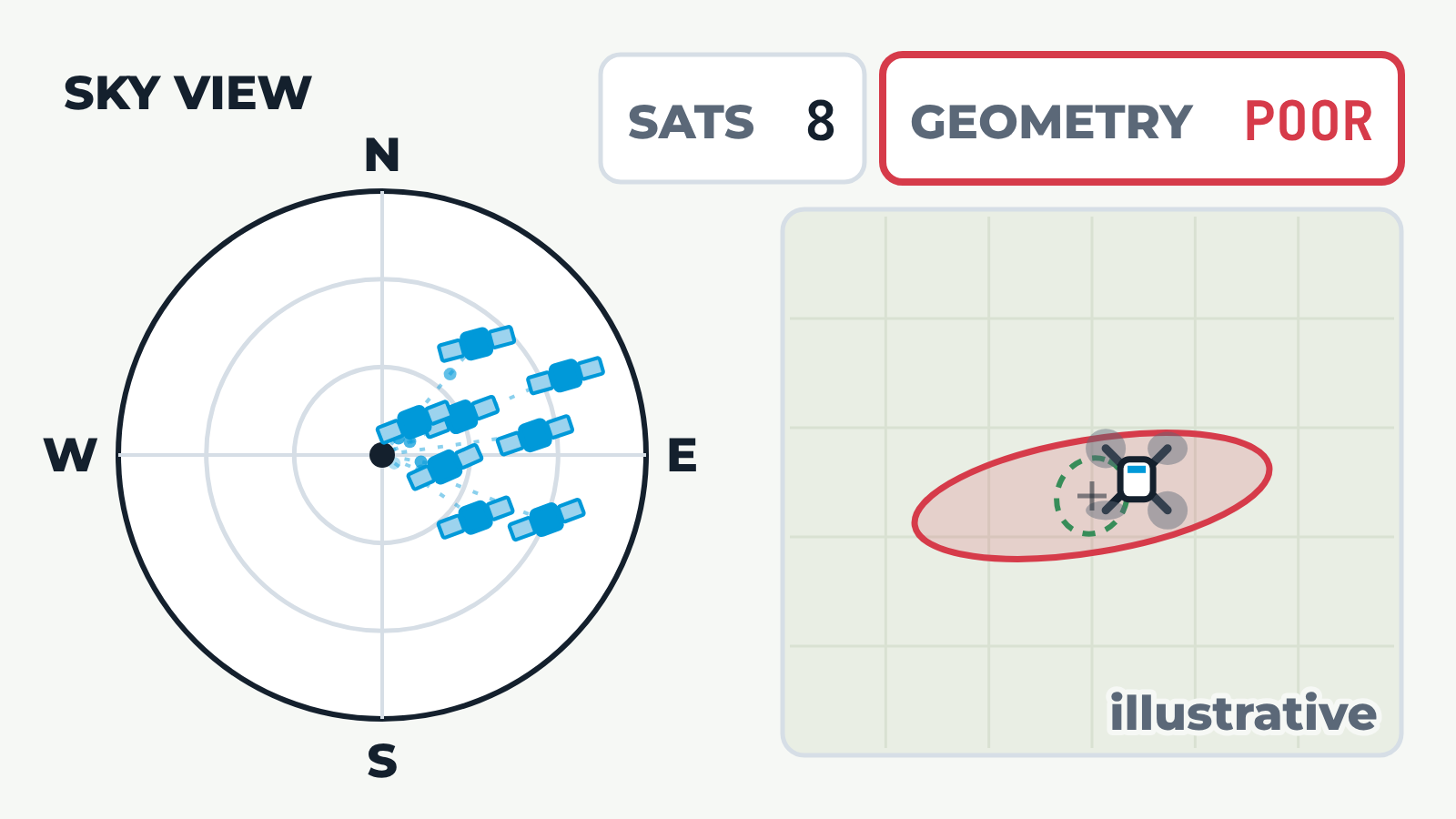
Left: a sky view looking up, with north at the top and the horizon as the outer ring. Satellites appear one by one and the satellite count rises. Right: the drone seen from above, inside a shaded area that shows how uncertain its GNSS position is. The size and shape of that area are worked out from where the satellites sit in the sky, but the scale is illustrative and no distances are given. Spread versus clustered: eight well-spread satellites give a small, round error area and good geometry. The same eight satellites then gather in one part of the sky. The count stays at eight, but the error area stretches into a long ellipse and the geometry is poor. Building edge: a building rises on the west side of the sky. The satellites behind it lose their signal, the count drops and the remaining satellites sit on one side, so the error area grows and stretches.