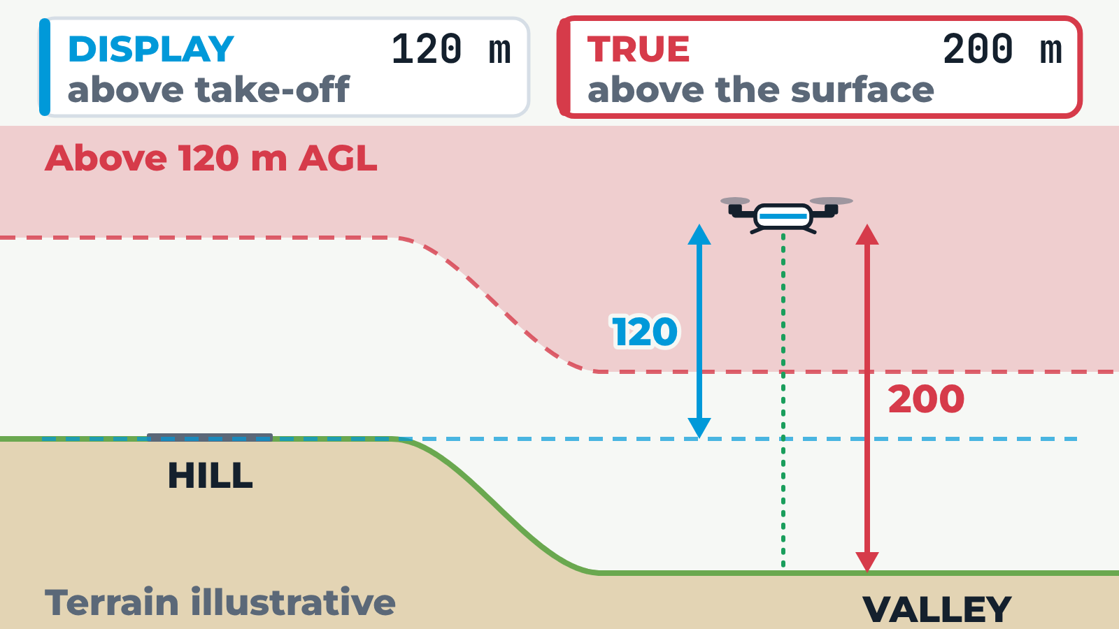
Side view of a drone flying over uneven terrain. Two readouts sit above it: DISPLAY, the height above take-off shown to the pilot, and TRUE, the height above the surface directly below. A dashed line follows the terrain 120 m above the surface, with the zone above it shaded red. Hill launch: the drone takes off from a hilltop, climbs to 120 m on the display and flies out over a valley 80 m lower. The display still reads 120 m, but the true height above the valley floor is 200 m, inside the red zone above the 120 m limit. Rising ground: the drone takes off in a valley and flies toward a hill 80 m higher; the display still reads 120 m, but it is only 40 m above the hill. With "120 m over surface" the drone follows the terrain so the true height stays 120 m, while the display changes. The 80 m terrain difference is illustrative.