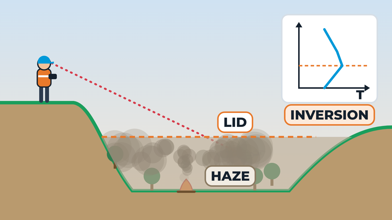
Valley cross-section with a pilot on a ridge and a drone flying low over the valley. A small inset graph shows temperature against height. Normal: temperature falls with height, and smoke from a fire on the valley floor rises and mixes away upward. Inversion: the graph shows warmer air above cooler air near the surface, forming a lid. The smoke rises only to the lid, then spreads sideways and a haze layer builds in the valley. The pilot's surroundings on the ridge stay clear, but the drone's flight path disappears into the haze and the line of sight turns red. Schematic; no temperatures or heights are shown.