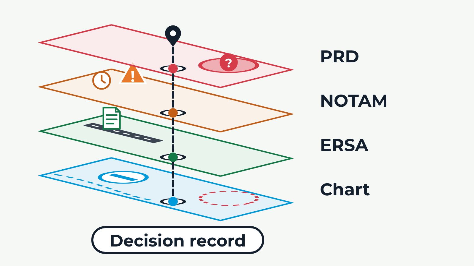
Four flat map sheets, seen at an angle, drop one at a time onto a stack. Each sheet shows the same area and the same drone worksite. Chart: an aerodrome symbol, a boundary line and the outline of a restricted area. ERSA: the aerodrome becomes a runway with an information document. NOTAM: a temporary warning marker with a clock appears at the aerodrome. PRD: the restricted area is shaded and pulses with a question mark for whether it is active. Finally a dashed line runs through the worksite on every layer and a 'Decision record' tag appears. Back and Next buttons step through the layers.