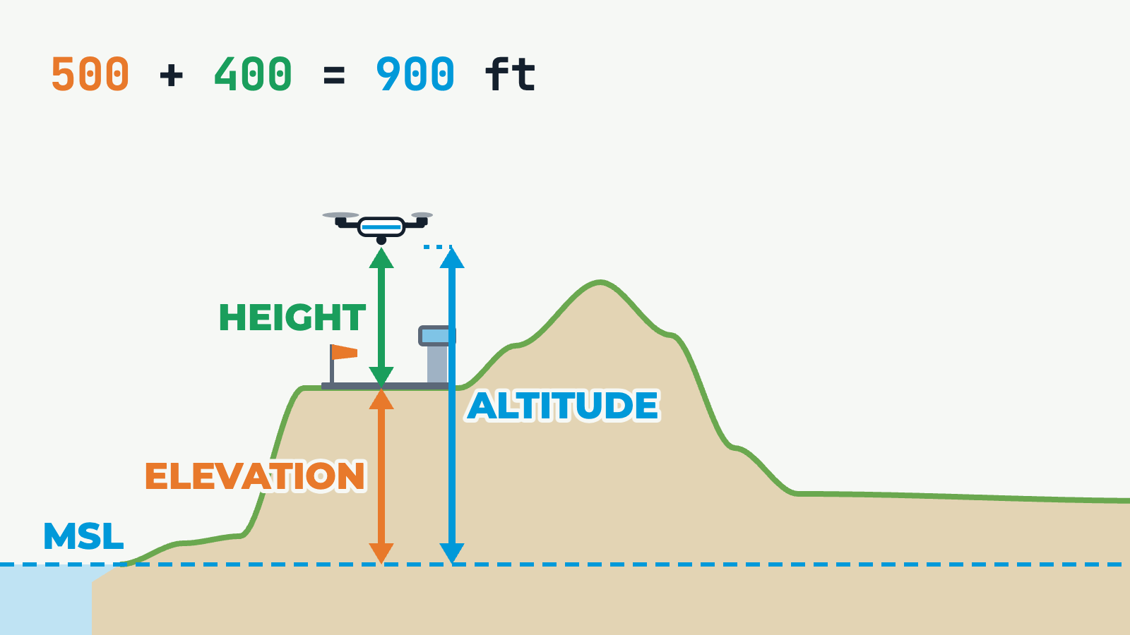
Cross-section of terrain above mean sea level (MSL): an aerodrome on a plateau at an example elevation of 500 ft, a hill, then lower ground. A drone flies across it and back. Three coloured measurements follow the drone. Elevation (orange) runs from MSL up to the ground below. Height (green) runs from the ground up to the drone, above ground level (AGL). Altitude (blue) runs from MSL up to the drone, above mean sea level (AMSL). An equation shows elevation plus height equals altitude. Over the aerodrome it reads 500 + 400 = 900 ft. Holding 400 ft AGL, the drone follows the terrain and its altitude changes. Holding 900 ft AMSL, its height changes and goes over the 400 ft AGL limit above low ground.